Atlajque geodata
Atlajque (San Luis Potosí) is a populated place; located in Mexico in America/Mexico_City (GMT-6) time zone. With population of 700 people, there are 12436 cities with bigger population in this country. Compared to other cities in Mexico, 79.3% of cities are located further ↓South; 53.5% of cities are located further ←West and 76.4% of cities have higher elevation than Atlajque. Note1


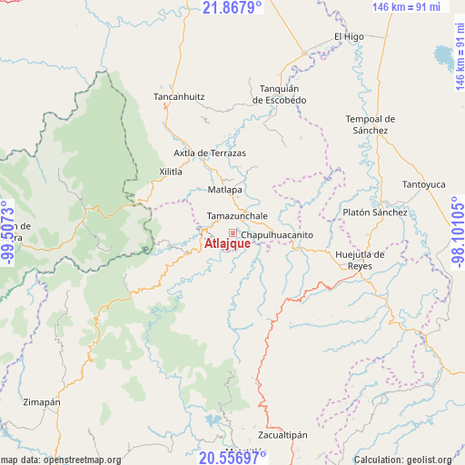
Atlajque GPS coordinates[2]
21° 12' 50.004" North, 98° 48' 15.012" West
| Map corner | latitude | longitude |
|---|---|---|
| Upper-left | 21.8679°, | -99.5073° |
| Center: | 21.21389°, | -98.80417° |
| Lower-right: | 20.55697°, | -98.10105° |
| Map W x H: | 145.8×145.8 km | = 90.6×90.6mi |
| max Lat: | 32.7° ⇑20.7% North |
| Atlajque: | 21.21389° |
| min Lat: | ⇓79.3% South 14.53588° |
| min Long | Atlajque | max Long |
| -117.105° | -98.80417° | -86.73105° |
| W 53.5%⇐ | ⇒46.5% E |
Elevation
Elevation of Atlajque is 171 m = 561 ft, and this is 1082.7 m = 3552 ft below average elevation for this country.
| Max E: |
3497 m = 11473 ft | 76.4% |
| Avg. | 1253.7 m = 4113 ft | |
| Atlajque | 171 m = 561 ft | |
Min E: |
-1 m = -3 ft | 23.6% |
See also: Mexico elevation on elevation.city.
Geographical zone
Atlajque is located in North Torrid zone (between Equator and Tropic of Cancer). Distance of this Northern Tropic circle is 247.2 km =153.6 mi to North.| Distance of | km | miles | from Atlajque |
|---|---|---|---|
| North Pole | 7648.3 | 4752.4 | to North |
| Arctic Circle | 5042.4 | 3133.2 | to North |
| Tropic Cancer | 247.2 | 153.6 | to North |
| Equator | 2358.8 | 1465.7 | to South |


Nearby cities:
15 places around Atlajque: (largest is in red/bold)
• Axhumol
2.7 km =1.7 mi,  114°
114°
• Coaxocotitla
3.2 km =2 mi,  97°
97°
• El Carrizal
4.4 km =2.7 mi,  228°
228°
• Enramaditas
1.3 km =0.8 mi,  193°
193°
• Ixtla (Ixtla Santiago)
5.4 km =3.4 mi,  256°
256°
• Mecatlán
1.3 km =0.8 mi,  62°
62°
• Papatlaco Santiago
4.2 km =2.6 mi,  288°
288°
• Pemucho
3.3 km =2.1 mi,  235°
235°
• Tacial
4.8 km =3 mi,  352°
352°
• Tamacol
3.2 km =2 mi,  317°
317°
• Tamazunchale
5.3 km =3.3 mi,  16°
16°
• Temamatla
5 km =3.1 mi, 62°
• Tetitla
2.9 km =1.8 mi, 262°
• Tezapotla
4.5 km =2.8 mi, 190°
• Tixcuayuca
3.4 km =2.1 mi, 193°
Sources, notices
• [Note1] Compared only with cities in Mexico existing in our database
• [Src1] Map data: © OpenStreetMap contributors (CC-BY-SA)
• [Src2] Other city data from geonames.org with taken over terms of usage.
• [Src3] Geographical zone / Annual Mean Temperature by Robert A. Rohde @ Wikipedia
