Tlachiquilillacapa geodata
Tlachiquilillacapa (San Luis Potosí) is a populated place; located in Mexico in America/Mexico_City (GMT-6) time zone. With population of 543 people, there are 15651 cities with bigger population in this country. Compared to other cities in Mexico, 78.9% of cities are located further ↓South; 53% of cities are located further ←West and 72.4% of cities have higher elevation than Tlachiquilillacapa. Note1


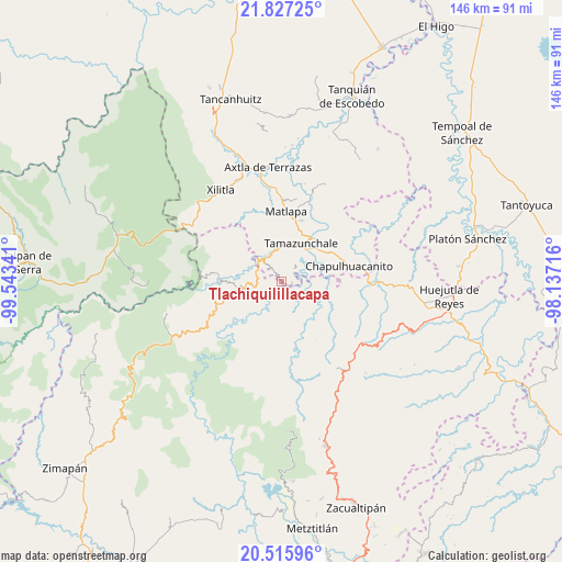
Tlachiquilillacapa GPS coordinates[2]
21° 10' 23.016" North, 98° 50' 25.008" West
| Map corner | latitude | longitude |
|---|---|---|
| Upper-left | 21.82725°, | -99.54341° |
| Center: | 21.17306°, | -98.84028° |
| Lower-right: | 20.51596°, | -98.13716° |
| Map W x H: | 145.8×145.8 km | = 90.6×90.6mi |
| max Lat: | 32.7° ⇑21.1% North |
| Tlachiquilillacapa: | 21.17306° |
| min Lat: | ⇓78.9% South 14.53588° |
| min Long | Tlachiquilillac | max Long |
| -117.105° | -98.84028° | -86.73105° |
| W 53%⇐ | ⇒47% E |
Elevation
Elevation of Tlachiquilillacapa is 317 m = 1040 ft, and this is 936.7 m = 3073 ft below average elevation for this country.
| Max E: |
3497 m = 11473 ft | 72.4% |
| Avg. | 1253.7 m = 4113 ft | |
| Tlachiquilillacapa | 317 m = 1040 ft | |
Min E: |
-1 m = -3 ft | 27.6% |
See also: Mexico elevation on elevation.city.
Geographical zone
Tlachiquilillacapa is located in North Torrid zone (between Equator and Tropic of Cancer). Distance of this Northern Tropic circle is 251.7 km =156.4 mi to North.| Distance of | km | miles | from Tlachiquilillacapa |
|---|---|---|---|
| North Pole | 7652.8 | 4755.2 | to North |
| Arctic Circle | 5047 | 3136.1 | to North |
| Tropic Cancer | 251.7 | 156.4 | to North |
| Equator | 2354.2 | 1462.8 | to South |


Nearby cities:
15 places around Tlachiquilillacapa: (largest is in red/bold)
• Amatitla Santiago
5.5 km =3.4 mi,  339°
339°
• Barrio Progreso
5.1 km =3.2 mi,  322°
322°
• Cahuazas
3.9 km =2.4 mi,  202°
202°
• Cahuazaz de Morelos (Rancho Alegre)
2.2 km =1.4 mi,  176°
176°
• El Carrizal
1.6 km =1 mi,  15°
15°
• Enramaditas
4.7 km =2.9 mi,  46°
46°
• Guaxcuaco
5.3 km =3.3 mi,  309°
309°
• Ixtla (Ixtla Santiago)
3.6 km =2.2 mi, 335°
• Pemucho
2.9 km =1.8 mi, 21°
• Santiago Centro
4.3 km =2.7 mi,  325°
325°
• Tetitla
4.3 km =2.7 mi,  11°
11°
• Tezapotla
2.9 km =1.8 mi,  88°
88°
• Tixcuayuca
3.2 km =2 mi,  67°
67°
• Tlalnepantla
1 km =0.6 mi, 321°
• Zacualtipanito
4.7 km =2.9 mi,  116°
116°
Sources, notices
• [Note1] Compared only with cities in Mexico existing in our database
• [Src1] Map data: © OpenStreetMap contributors (CC-BY-SA)
• [Src2] Other city data from geonames.org with taken over terms of usage.
• [Src3] Geographical zone / Annual Mean Temperature by Robert A. Rohde @ Wikipedia
