El Carrizo geodata
El Carrizo (San Luis Potosí) is a populated place; located in Mexico in America/Mexico_City (GMT-6) time zone. With population of 517 people, there are 16282 cities with bigger population in this country. Compared to other cities in Mexico, 82.9% of cities are located further ↓South; 53.9% of cities are located further ←West and 83% of cities have higher elevation than El Carrizo. Note1


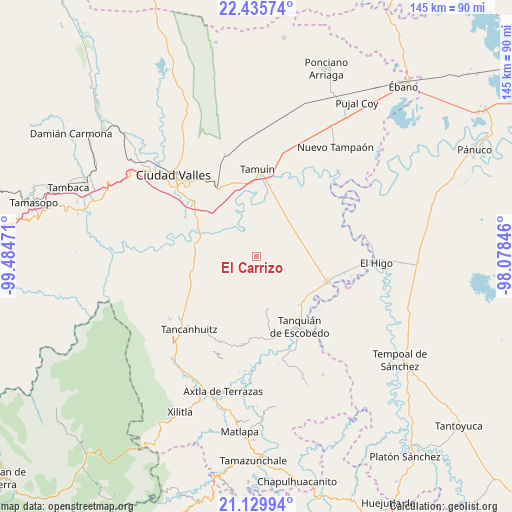
El Carrizo GPS coordinates[2]
21° 47' 3.588" North, 98° 46' 53.688" West
| Map corner | latitude | longitude |
|---|---|---|
| Upper-left | 22.43574°, | -99.48471° |
| Center: | 21.78433°, | -98.78158° |
| Lower-right: | 21.12994°, | -98.07846° |
| Map W x H: | 145.2×145.2 km | = 90.2×90.2mi |
| max Lat: | 32.7° ⇑17.1% North |
| El Carrizo: | 21.78433° |
| min Lat: | ⇓82.9% South 14.53588° |
| min Long | El Carrizo | max Long |
| -117.105° | -98.78158° | -86.73105° |
| W 53.9%⇐ | ⇒46.1% E |
Elevation
Elevation of El Carrizo is 60 m = 197 ft, and this is 1193.7 m = 3916 ft below average elevation for this country.
| Max E: |
3497 m = 11473 ft | 83% |
| Avg. | 1253.7 m = 4113 ft | |
| El Carrizo | 60 m = 197 ft | |
Min E: |
-1 m = -3 ft | 17% |
See also: Mexico elevation on elevation.city.
Geographical zone
El Carrizo is located in North Torrid zone (between Equator and Tropic of Cancer). Distance of this Northern Tropic circle is 183.7 km =114.1 mi to North.| Distance of | km | miles | from El Carrizo |
|---|---|---|---|
| North Pole | 7584.9 | 4713 | to North |
| Arctic Circle | 4979 | 3093.8 | to North |
| Tropic Cancer | 183.7 | 114.1 | to North |
| Equator | 2422.2 | 1505.1 | to South |


Nearby cities:
15 places around El Carrizo: (largest is in red/bold)
• Coromohom (Tocoymohom)
16.3 km =10.1 mi,  223°
223°
• Ejido San José Xilatzén
19.4 km =12.1 mi,  231°
231°
• Ejido el Barrancón
14.9 km =9.3 mi,  213°
213°
• El Fortín May
11 km =6.8 mi, 212°
• Las Lomas
18.8 km =11.7 mi,  152°
152°
• Nueva Primavera
16.4 km =10.2 mi,  331°
331°
• Nuevo Cueytzén
13.7 km =8.5 mi, 223°
• Sagrada Familia
18.7 km =11.6 mi,  138°
138°
• San Francisco Cuayalab
8.8 km =5.5 mi,  131°
131°
• San Nicolás
11.9 km =7.4 mi,  178°
178°
• Santa Elena
14.9 km =9.3 mi, 136°
• Santa Martha
15 km =9.3 mi,  168°
168°
• Tanlajás
17.1 km =10.6 mi, 219°
• Tantóbal
16.4 km =10.2 mi,  269°
269°
• Tocoy
18.6 km =11.6 mi, 209°
Sources, notices
• [Note1] Compared only with cities in Mexico existing in our database
• [Src1] Map data: © OpenStreetMap contributors (CC-BY-SA)
• [Src2] Other city data from geonames.org with taken over terms of usage.
• [Src3] Geographical zone / Annual Mean Temperature by Robert A. Rohde @ Wikipedia
