El Fortín May geodata
El Fortín May (San Luis Potosí) is a populated place; located in Mexico in America/Mexico_City (GMT-6) time zone. With population of 525 people, there are 16085 cities with bigger population in this country. Compared to other cities in Mexico, 82.5% of cities are located further ↓South; 53% of cities are located further ←West and 77.1% of cities have higher elevation than El Fortín May. Note1


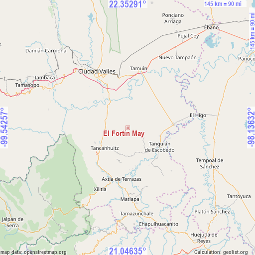
El Fortín May GPS coordinates[2]
21° 42' 3.996" North, 98° 50' 21.984" West
| Map corner | latitude | longitude |
|---|---|---|
| Upper-left | 22.35291°, | -99.54257° |
| Center: | 21.70111°, | -98.83944° |
| Lower-right: | 21.04635°, | -98.13632° |
| Map W x H: | 145.3×145.3 km | = 90.3×90.3mi |
| max Lat: | 32.7° ⇑17.5% North |
| El Fortín May: | 21.70111° |
| min Lat: | ⇓82.5% South 14.53588° |
| min Long | El Fortín May | max Long |
| -117.105° | -98.83944° | -86.73105° |
| W 53%⇐ | ⇒47% E |
Elevation
Elevation of El Fortín May is 151 m = 495 ft, and this is 1102.7 m = 3618 ft below average elevation for this country.
| Max E: |
3497 m = 11473 ft | 77.1% |
| Avg. | 1253.7 m = 4113 ft | |
| El Fortín May | 151 m = 495 ft | |
Min E: |
-1 m = -3 ft | 22.9% |
See also: Mexico elevation on elevation.city.
Geographical zone
El Fortín May is located in North Torrid zone (between Equator and Tropic of Cancer). Distance of this Northern Tropic circle is 193 km =119.9 mi to North.| Distance of | km | miles | from El Fortín May |
|---|---|---|---|
| North Pole | 7594.1 | 4718.8 | to North |
| Arctic Circle | 4988.2 | 3099.5 | to North |
| Tropic Cancer | 193 | 119.9 | to North |
| Equator | 2412.9 | 1499.3 | to South |


Nearby cities:
15 places around El Fortín May: (largest is in red/bold)
• Coromohom (Tocoymohom)
5.8 km =3.6 mi,  243°
243°
• Ejido San José Xilatzén
9.6 km =6 mi,  252°
252°
• Ejido el Barrancón
3.9 km =2.4 mi,  213°
213°
• El Carrizo
11 km =6.8 mi,  32°
32°
• Las Armas
13.2 km =8.2 mi,  267°
267°
• Lejem
10.6 km =6.6 mi,  195°
195°
• Nuevo Cueytzén
3.5 km =2.2 mi,  259°
259°
• San Antonio
11.1 km =6.9 mi,  216°
216°
• San Francisco Cuayalab
13.1 km =8.1 mi,  74°
74°
• San Nicolás
6.9 km =4.3 mi,  112°
112°
• Santa Martha
10.5 km =6.5 mi,  121°
121°
• Tan Jajnec
9.3 km =5.8 mi, 217°
• Tanlajás
6.3 km =3.9 mi,  230°
230°
• Tantóbal
13.9 km =8.6 mi,  311°
311°
• Tocoy
7.7 km =4.8 mi, 205°
Sources, notices
• [Note1] Compared only with cities in Mexico existing in our database
• [Src1] Map data: © OpenStreetMap contributors (CC-BY-SA)
• [Src2] Other city data from geonames.org with taken over terms of usage.
• [Src3] Geographical zone / Annual Mean Temperature by Robert A. Rohde @ Wikipedia
