El Limonal geodata
El Limonal (San Luis Potosí) is a populated place; located in Mexico in America/Mexico_City (GMT-6) time zone. With population of 542 people, there are 15673 cities with bigger population in this country. Compared to other cities in Mexico, 87% of cities are located further ↓South; 56.3% of cities are located further →East and 66.9% of cities have higher elevation than El Limonal. Note1


El Limonal GPS coordinates[2]
22° 35' 29.58" North, 99° 27' 17.964" West
| Map corner | latitude | longitude |
|---|---|---|
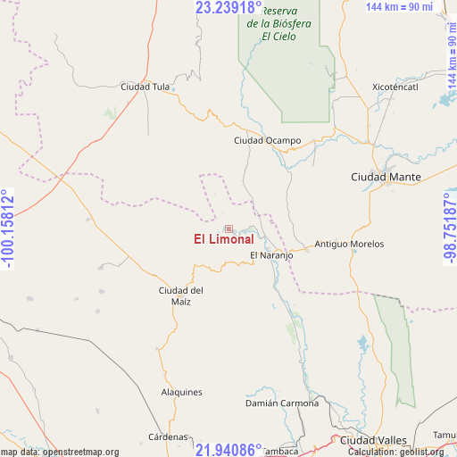
| Upper-left | 23.23918°, | -100.15812° |
| Center: | 22.59155°, | -99.45499° |
| Lower-right: | 21.94086°, | -98.75187° |
| Map W x H: | 144.4×144.4 km | = 89.7×89.7mi |
| max Lat: | 32.7° ⇑13% North |
| El Limonal: | 22.59155° |
| min Lat: | ⇓87% South 14.53588° |
| min Long | El Limonal | max Long |
| -117.105° | -99.45499° | -86.73105° |
| W 43.7%⇐ | ⇒56.3% E |
Elevation
Elevation of El Limonal is 588 m = 1929 ft, and this is 665.7 m = 2184 ft below average elevation for this country.
| Max E: |
3497 m = 11473 ft | 66.9% |
| Avg. | 1253.7 m = 4113 ft | |
| El Limonal | 588 m = 1929 ft | |
Min E: |
-1 m = -3 ft | 33.1% |
See also: Mexico elevation on elevation.city.
Geographical zone
El Limonal is located in North Torrid zone (between Equator and Tropic of Cancer). Distance of this Northern Tropic circle is 94 km =58.4 mi to North.| Distance of | km | miles | from El Limonal |
|---|---|---|---|
| North Pole | 7495.1 | 4657.2 | to North |
| Arctic Circle | 4889.2 | 3038 | to North |
| Tropic Cancer | 94 | 58.4 | to North |
| Equator | 2511.9 | 1560.8 | to South |


Nearby cities:
15 places around El Limonal: (largest is in red/bold)
• Adolfo López Mateos
38.8 km =24.1 mi,  43°
43°
• Antiguo Morelos
38.7 km =24 mi,  96°
96°
• Ciudad del Maíz
26.1 km =16.2 mi,  216°
216°
• El Naranjo
14.8 km =9.2 mi,  119°
119°
• El Pensil
13.8 km =8.6 mi,  23°
23°
• El Sabinito
11.8 km =7.3 mi,  134°
134°
• Lagunillas
31.3 km =19.4 mi,  201°
201°
• Maitinez
29.6 km =18.4 mi,  145°
145°
• Mexico Libre
30.8 km =19.1 mi,  79°
79°
• Minas Viejas
24.2 km =15 mi, 149°
• Nuevo Morelos
25 km =15.5 mi, 104°
• Ocampo
30.8 km =19.1 mi, 22°
• Praxedis Guerrero
41.2 km =25.6 mi,  87°
87°
• Ricardo Flores Magon
15.5 km =9.6 mi, 15°
• Zamachihue
22.6 km =14 mi,  246°
246°
Sources, notices
• [Note1] Compared only with cities in Mexico existing in our database
• [Src1] Map data: © OpenStreetMap contributors (CC-BY-SA)
• [Src2] Other city data from geonames.org with taken over terms of usage.
• [Src3] Geographical zone / Annual Mean Temperature by Robert A. Rohde @ Wikipedia
