Lagunillas geodata
Lagunillas (San Luis Potosí) is a populated place; located in Mexico in America/Mexico_City (GMT-6) time zone. With population of 692 people, there are 12576 cities with bigger population in this country. Compared to other cities in Mexico, 85.9% of cities are located further ↓South; 57.9% of cities are located further →East and 50.6% of cities have higher elevation than Lagunillas. Note1


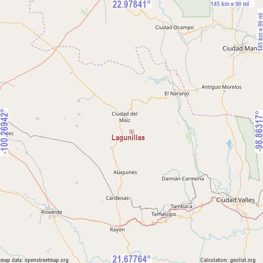
Lagunillas GPS coordinates[2]
22° 19' 46.344" North, 99° 33' 58.644" West
| Map corner | latitude | longitude |
|---|---|---|
| Upper-left | 22.97841°, | -100.26942° |
| Center: | 22.32954°, | -99.56629° |
| Lower-right: | 21.67764°, | -98.86317° |
| Map W x H: | 144.6×144.6 km | = 89.9×89.9mi |
| max Lat: | 32.7° ⇑14.1% North |
| Lagunillas: | 22.32954° |
| min Lat: | ⇓85.9% South 14.53588° |
| min Long | Lagunillas | max Long |
| -117.105° | -99.56629° | -86.73105° |
| W 42.1%⇐ | ⇒57.9% E |
Elevation
Elevation of Lagunillas is 1400 m = 4593 ft, and this is 146.3 m = 480 ft above average elevation for this country.
| Max E: |
3497 m = 11473 ft | 50.6% |
| Lagunillas | 1400 m 4593 ft | |
| Avg. | 1253.7 m = 4113 ft | |
Min E: |
-1 m = -3 ft | 49.4% |
See also: Mexico elevation on elevation.city.
Geographical zone
Lagunillas is located in North Torrid zone (between Equator and Tropic of Cancer). Distance of this Northern Tropic circle is 123.1 km =76.5 mi to North.| Distance of | km | miles | from Lagunillas |
|---|---|---|---|
| North Pole | 7524.2 | 4675.3 | to North |
| Arctic Circle | 4918.4 | 3056.2 | to North |
| Tropic Cancer | 123.1 | 76.5 | to North |
| Equator | 2482.8 | 1542.7 | to South |


Nearby cities:
15 places around Lagunillas: (largest is in red/bold)
• Alaquines
22.5 km =14 mi,  189°
189°
• Cañada
30.4 km =18.9 mi,  176°
176°
• Ciudad del Maíz
9 km =5.6 mi,  333°
333°
• Colonia la Libertad
30.4 km =18.9 mi,  288°
288°
• Colonia Álvaro Obregón
14.1 km =8.8 mi,  232°
232°
• El Limonal
31.3 km =19.4 mi,  21°
21°
• El Naranjo
32.7 km =20.3 mi,  48°
48°
• El Sabinito
28.9 km =18 mi,  43°
43°
• El Sabino
33.7 km =20.9 mi, 177°
• Maitinez
28.5 km =17.7 mi,  80°
80°
• Martinez
29.7 km =18.5 mi, 191°
• Minas Viejas
25.1 km =15.6 mi,  70°
70°
• Palomas
33.6 km =20.9 mi,  300°
300°
• Rancho de Pro
26 km =16.2 mi, 182°
• Zamachihue
22.1 km =13.7 mi,  335°
335°
Sources, notices
• [Note1] Compared only with cities in Mexico existing in our database
• [Src1] Map data: © OpenStreetMap contributors (CC-BY-SA)
• [Src2] Other city data from geonames.org with taken over terms of usage.
• [Src3] Geographical zone / Annual Mean Temperature by Robert A. Rohde @ Wikipedia
