Zamachihue geodata
Zamachihue (San Luis Potosí) is a populated place; located in Mexico in America/Mexico_City (GMT-6) time zone. With population of 1,408 people, there are 6143 cities with bigger population in this country. Compared to other cities in Mexico, 86.7% of cities are located further ↓South; 59.6% of cities are located further →East and 53.2% of cities have higher elevation than Zamachihue. Note1


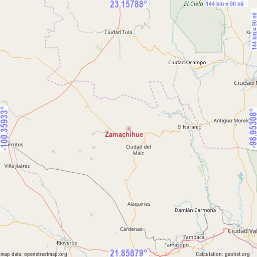
Zamachihue GPS coordinates[2]
22° 30' 35.496" North, 99° 39' 22.32" West
| Map corner | latitude | longitude |
|---|---|---|
| Upper-left | 23.15788°, | -100.35933° |
| Center: | 22.50986°, | -99.6562° |
| Lower-right: | 21.85879°, | -98.95308° |
| Map W x H: | 144.4×144.4 km | = 89.7×89.7mi |
| max Lat: | 32.7° ⇑13.3% North |
| Zamachihue: | 22.50986° |
| min Lat: | ⇓86.7% South 14.53588° |
| min Long | Zamachihue | max Long |
| -117.105° | -99.6562° | -86.73105° |
| W 40.4%⇐ | ⇒59.6% E |
Elevation
Elevation of Zamachihue is 1283 m = 4209 ft, and this is 29.3 m = 96 ft above average elevation for this country.
| Max E: |
3497 m = 11473 ft | 53.2% |
| Zamachihue | 1283 m 4209 ft | |
| Avg. | 1253.7 m = 4113 ft | |
Min E: |
-1 m = -3 ft | 46.8% |
See also: Mexico elevation on elevation.city.
Geographical zone
Zamachihue is located in North Torrid zone (between Equator and Tropic of Cancer). Distance of this Northern Tropic circle is 103.1 km =64.1 mi to North.| Distance of | km | miles | from Zamachihue |
|---|---|---|---|
| North Pole | 7504.2 | 4662.9 | to North |
| Arctic Circle | 4898.3 | 3043.7 | to North |
| Tropic Cancer | 103.1 | 64.1 | to North |
| Equator | 2502.9 | 1555.2 | to South |


Nearby cities:
15 places around Zamachihue: (largest is in red/bold)
• Ciudad del Maíz
13.1 km =8.1 mi,  156°
156°
• Colonia la Libertad
22.4 km =13.9 mi,  241°
241°
• Colonia Álvaro Obregón
28.7 km =17.8 mi,  183°
183°
• El Custodio
35.8 km =22.2 mi,  296°
296°
• El Limonal
22.6 km =14 mi,  66°
66°
• El Naranjo
33.6 km =20.9 mi,  86°
86°
• El Pensil
34 km =21.1 mi,  50°
50°
• El Sabinito
29.2 km =18.1 mi, 88°
• Lagunillas
22.1 km =13.7 mi, 155°
• Maitinez
40.4 km =25.1 mi,  112°
112°
• Minas Viejas
34.9 km =21.7 mi, 109°
• Palomas
20.1 km =12.5 mi,  260°
260°
• Ricardo Flores Magon
34.6 km =21.5 mi, 46°
• San Rafael Matriz
26.8 km =16.7 mi, 297°
• Tanque de los Ángeles
30.3 km =18.8 mi, 244°
Sources, notices
• [Note1] Compared only with cities in Mexico existing in our database
• [Src1] Map data: © OpenStreetMap contributors (CC-BY-SA)
• [Src2] Other city data from geonames.org with taken over terms of usage.
• [Src3] Geographical zone / Annual Mean Temperature by Robert A. Rohde @ Wikipedia
