San José Yocnajab geodata
San José Yocnajab (Chiapas) is a populated place; located in Mexico in America/Mexico_City (GMT-6) time zone. With population of 1,809 people, there are 4812 cities with bigger population in this country. Compared to other cities in Mexico, 96% of cities are located further ↑North; 94.9% of cities are located further ←West and 55.4% of cities have lower elevation than San José Yocnajab. Note1


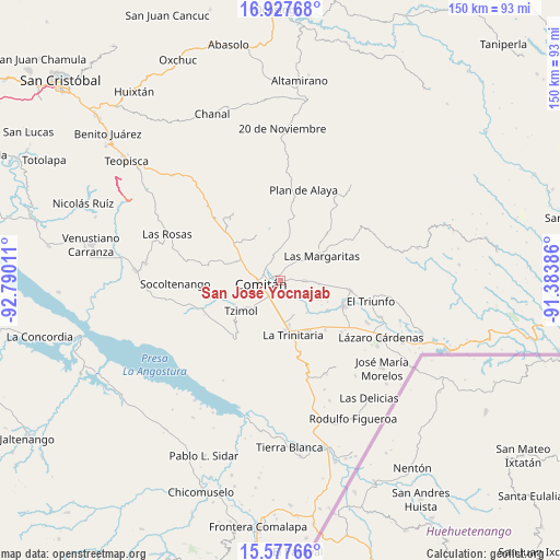
San José Yocnajab GPS coordinates[2]
16° 15' 13.788" North, 92° 5' 13.128" West
| Map corner | latitude | longitude |
|---|---|---|
| Upper-left | 16.92768°, | -92.79011° |
| Center: | 16.25383°, | -92.08698° |
| Lower-right: | 15.57766°, | -91.38386° |
| Map W x H: | 150.1×150.1 km | = 93.3×93.3mi |
| max Lat: | 32.7° ⇑96% North |
| San José Yocnajab: | 16.25383° |
| min Lat: | ⇓4% South 14.53588° |
| min Long | San José Yocna | max Long |
| -117.105° | -92.08698° | -86.73105° |
| W 94.9%⇐ | ⇒5.1% E |
Elevation
Elevation of San José Yocnajab is 1600 m = 5249 ft, and this is 346.3 m = 1136 ft above average elevation for this country.
| Max E: |
3497 m = 11473 ft | 44.6% |
| San José Yocnajab | 1600 m 5249 ft | |
| Avg. | 1253.7 m = 4113 ft | |
Min E: |
-1 m = -3 ft | 55.4% |
See also: Mexico elevation on elevation.city.
Geographical zone
San José Yocnajab is located in North Torrid zone (between Equator and Tropic of Cancer). Distance of this Northern Tropic circle is 798.7 km =496.3 mi to North.| Distance of | km | miles | from San José Yocnajab |
|---|---|---|---|
| North Pole | 8199.8 | 5095.1 | to North |
| Arctic Circle | 5593.9 | 3475.9 | to North |
| Tropic Cancer | 798.7 | 496.3 | to North |
| Equator | 1807.3 | 1123 | to South |


Nearby cities:
15 places around San José Yocnajab: (largest is in red/bold)
• Cajcam
4.2 km =2.6 mi,  70°
70°
• Cash
1.6 km =1 mi,  315°
315°
• Comitán
5.2 km =3.2 mi,  261°
261°
• Guadalupe Quistaj
7.2 km =4.5 mi,  128°
128°
• La Independencia
6.8 km =4.2 mi,  91°
91°
• Los Riegos
6.9 km =4.3 mi, 324°
• Primero de Mayo
6.8 km =4.2 mi,  61°
61°
• Quija
6.7 km =4.2 mi,  288°
288°
• Río Grande
4.9 km =3 mi,  305°
305°
• San Francisco el Rincón
5.8 km =3.6 mi,  301°
301°
• San Isidro Tinajab
4.5 km =2.8 mi,  327°
327°
• San Miguel Tinajab
3.5 km =2.2 mi, 330°
• San Rafael Jocom
6.4 km =4 mi, 318°
• Santo Domingo de las Granadas
6.7 km =4.2 mi, 331°
• Señor del Pozo
5.4 km =3.4 mi, 330°
Sources, notices
• [Note1] Compared only with cities in Mexico existing in our database
• [Src1] Map data: © OpenStreetMap contributors (CC-BY-SA)
• [Src2] Other city data from geonames.org with taken over terms of usage.
• [Src3] Geographical zone / Annual Mean Temperature by Robert A. Rohde @ Wikipedia
