Río Grande geodata
Río Grande (Chiapas) is a populated place; located in Mexico in America/Mexico_City (GMT-6) time zone. With population of 841 people, there are 10405 cities with bigger population in this country. Compared to other cities in Mexico, 95.8% of cities are located further ↑North; 94.7% of cities are located further ←West and 54% of cities have lower elevation than Río Grande. Note1


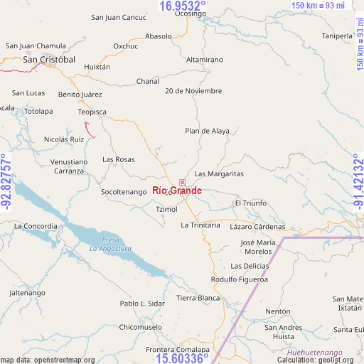
Río Grande GPS coordinates[2]
16° 16' 45.984" North, 92° 7' 27.984" West
| Map corner | latitude | longitude |
|---|---|---|
| Upper-left | 16.9532°, | -92.82757° |
| Center: | 16.27944°, | -92.12444° |
| Lower-right: | 15.60336°, | -91.42132° |
| Map W x H: | 150.1×150.1 km | = 93.3×93.3mi |
| max Lat: | 32.7° ⇑95.8% North |
| Río Grande: | 16.27944° |
| min Lat: | ⇓4.2% South 14.53588° |
| min Long | Río Grande | max Long |
| -117.105° | -92.12444° | -86.73105° |
| W 94.7%⇐ | ⇒5.3% E |
Elevation
Elevation of Río Grande is 1562 m = 5125 ft, and this is 308.3 m = 1011 ft above average elevation for this country.
| Max E: |
3497 m = 11473 ft | 46% |
| Río Grande | 1562 m 5125 ft | |
| Avg. | 1253.7 m = 4113 ft | |
Min E: |
-1 m = -3 ft | 54% |
See also: Mexico elevation on elevation.city.
Geographical zone
Río Grande is located in North Torrid zone (between Equator and Tropic of Cancer). Distance of this Northern Tropic circle is 795.8 km =494.5 mi to North.| Distance of | km | miles | from Río Grande |
|---|---|---|---|
| North Pole | 8197 | 5093.4 | to North |
| Arctic Circle | 5591.1 | 3474.1 | to North |
| Tropic Cancer | 795.8 | 494.5 | to North |
| Equator | 1810.1 | 1124.7 | to South |


Nearby cities:
15 places around Río Grande: (largest is in red/bold)
• Cajcam
8.1 km =5 mi,  100°
100°
• Cash
3.3 km =2.1 mi,  120°
120°
• Chacaljocóm
6.7 km =4.2 mi,  289°
289°
• Comitán
3.8 km =2.4 mi,  197°
197°
• Los Riegos
2.8 km =1.7 mi,  0°
0°
• Primero de Mayo
10 km =6.2 mi,  87°
87°
• Quija
2.5 km =1.6 mi,  253°
253°
• San Francisco el Rincón
1 km =0.6 mi,  282°
282°
• San Isidro Tinajab
1.8 km =1.1 mi,  57°
57°
• San José Yocnajab
4.9 km =3 mi,  125°
125°
• San Miguel Tinajab
2.3 km =1.4 mi,  83°
83°
• San Rafael Jocom
2 km =1.2 mi,  352°
352°
• Santo Domingo de las Granadas
3.2 km =2 mi,  14°
14°
• Señor del Pozo
2.3 km =1.4 mi,  36°
36°
• Villahermosa Yaluma
7.8 km =4.8 mi, 39°
Sources, notices
• [Note1] Compared only with cities in Mexico existing in our database
• [Src1] Map data: © OpenStreetMap contributors (CC-BY-SA)
• [Src2] Other city data from geonames.org with taken over terms of usage.
• [Src3] Geographical zone / Annual Mean Temperature by Robert A. Rohde @ Wikipedia
