Cash geodata
Cash (Chiapas) is a populated place; located in Mexico in America/Mexico_City (GMT-6) time zone. With population of 1,429 people, there are 6041 cities with bigger population in this country. Compared to other cities in Mexico, 95.9% of cities are located further ↑North; 94.8% of cities are located further ←West and 55.2% of cities have lower elevation than Cash. Note1


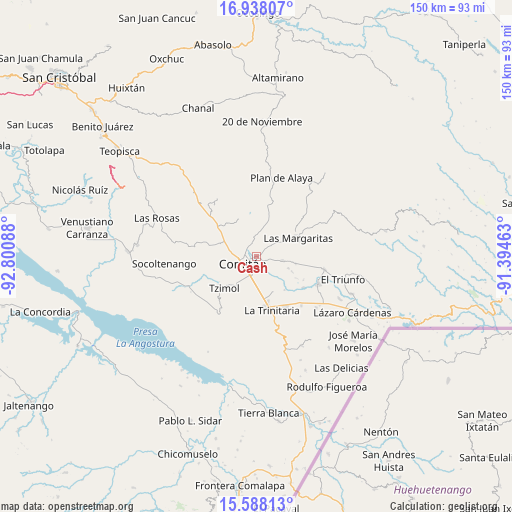
Cash GPS coordinates[2]
16° 15' 51.336" North, 92° 5' 51.9" West
| Map corner | latitude | longitude |
|---|---|---|
| Upper-left | 16.93807°, | -92.80088° |
| Center: | 16.26426°, | -92.09775° |
| Lower-right: | 15.58813°, | -91.39463° |
| Map W x H: | 150.1×150.1 km | = 93.3×93.3mi |
| max Lat: | 32.7° ⇑95.9% North |
| Cash: | 16.26426° |
| min Lat: | ⇓4.1% South 14.53588° |
| min Long | Cash | max Long |
| -117.105° | -92.09775° | -86.73105° |
| W 94.8%⇐ | ⇒5.2% E |
Elevation
Elevation of Cash is 1594 m = 5230 ft, and this is 340.3 m = 1116 ft above average elevation for this country.
| Max E: |
3497 m = 11473 ft | 44.8% |
| Cash | 1594 m 5230 ft | |
| Avg. | 1253.7 m = 4113 ft | |
Min E: |
-1 m = -3 ft | 55.2% |
See also: Mexico elevation on elevation.city.
Geographical zone
Cash is located in North Torrid zone (between Equator and Tropic of Cancer). Distance of this Northern Tropic circle is 797.5 km =495.5 mi to North.| Distance of | km | miles | from Cash |
|---|---|---|---|
| North Pole | 8198.6 | 5094.4 | to North |
| Arctic Circle | 5592.8 | 3475.2 | to North |
| Tropic Cancer | 797.5 | 495.5 | to North |
| Equator | 1808.4 | 1123.7 | to South |


Nearby cities:
15 places around Cash: (largest is in red/bold)
• Cajcam
5.1 km =3.2 mi,  86°
86°
• Comitán
4.4 km =2.7 mi,  244°
244°
• La Independencia
8 km =5 mi,  99°
99°
• Los Riegos
5.3 km =3.3 mi,  327°
327°
• Primero de Mayo
7.5 km =4.7 mi,  73°
73°
• Quija
5.3 km =3.3 mi,  280°
280°
• Río Grande
3.3 km =2.1 mi,  300°
300°
• San Francisco el Rincón
4.2 km =2.6 mi, 296°
• San Isidro Tinajab
3 km =1.9 mi, 333°
• San José Yocnajab
1.6 km =1 mi,  135°
135°
• San Miguel Tinajab
2 km =1.2 mi,  343°
343°
• San Rafael Jocom
4.8 km =3 mi,  319°
319°
• Santo Domingo de las Granadas
5.2 km =3.2 mi, 336°
• Señor del Pozo
3.9 km =2.4 mi, 337°
• Villahermosa Yaluma
8 km =5 mi,  15°
15°
Sources, notices
• [Note1] Compared only with cities in Mexico existing in our database
• [Src1] Map data: © OpenStreetMap contributors (CC-BY-SA)
• [Src2] Other city data from geonames.org with taken over terms of usage.
• [Src3] Geographical zone / Annual Mean Temperature by Robert A. Rohde @ Wikipedia
