Unión Roja geodata
Unión Roja (Chiapas) is a populated place; located in Mexico in America/Mexico_City (GMT-6) time zone. With population of 1,829 people, there are 4753 cities with bigger population in this country. Compared to other cities in Mexico, 99.4% of cities are located further ↑North; 94% of cities are located further ←West and 68% of cities have higher elevation than Unión Roja. Note1


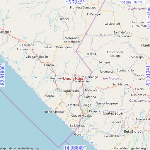
Unión Roja GPS coordinates[2]
15° 2' 47.688" North, 92° 12' 59.508" West
| Map corner | latitude | longitude |
|---|---|---|
| Upper-left | 15.7245°, | -92.91966° |
| Center: | 15.04658°, | -92.21653° |
| Lower-right: | 14.36649°, | -91.51341° |
| Map W x H: | 151×151 km | = 93.8×93.8mi |
| max Lat: | 32.7° ⇑99.4% North |
| Unión Roja: | 15.04658° |
| min Lat: | ⇓0.6% South 14.53588° |
| min Long | Unión Roja | max Long |
| -117.105° | -92.21653° | -86.73105° |
| W 94%⇐ | ⇒6% E |
Elevation
Elevation of Unión Roja is 529 m = 1736 ft, and this is 724.7 m = 2378 ft below average elevation for this country.
| Max E: |
3497 m = 11473 ft | 68% |
| Avg. | 1253.7 m = 4113 ft | |
| Unión Roja | 529 m = 1736 ft | |
Min E: |
-1 m = -3 ft | 32% |
See also: Mexico elevation on elevation.city.
Geographical zone
Unión Roja is located in North Torrid zone (between Equator and Tropic of Cancer). Distance of this Northern Tropic circle is 932.9 km =579.7 mi to North.| Distance of | km | miles | from Unión Roja |
|---|---|---|---|
| North Pole | 8334 | 5178.5 | to North |
| Arctic Circle | 5728.2 | 3559.3 | to North |
| Tropic Cancer | 932.9 | 579.7 | to North |
| Equator | 1673 | 1039.6 | to South |


Nearby cities:
15 places around Unión Roja: (largest is in red/bold)
• 26 de Octubre
5.7 km =3.5 mi,  318°
318°
• Agustín de Iturbide
3.7 km =2.3 mi,  31°
31°
• Ahuacatlán
3.9 km =2.4 mi,  100°
100°
• Alpujarras
5.7 km =3.5 mi,  57°
57°
• Benito Juárez
2.9 km =1.8 mi,  71°
71°
• Carrillo Puerto
4.5 km =2.8 mi,  150°
150°
• El Carmen
6 km =3.7 mi,  107°
107°
• El Progreso
4.9 km =3 mi,  24°
24°
• Fracción Galeras
1.7 km =1.1 mi,  298°
298°
• Fracción las Palmas
1.9 km =1.2 mi,  263°
263°
• Los Ángeles
2.9 km =1.8 mi,  168°
168°
• Salvador Urbina
1.5 km =0.9 mi,  143°
143°
• San Agustín Jitotol
5.5 km =3.4 mi,  179°
179°
• San Antonio Chicharras
5.6 km =3.5 mi,  330°
330°
• Toluca
3.6 km =2.2 mi,  235°
235°
Sources, notices
• [Note1] Compared only with cities in Mexico existing in our database
• [Src1] Map data: © OpenStreetMap contributors (CC-BY-SA)
• [Src2] Other city data from geonames.org with taken over terms of usage.
• [Src3] Geographical zone / Annual Mean Temperature by Robert A. Rohde @ Wikipedia
