San Andrés Tlalamac geodata
San Andrés Tlalamac (State of Mexico) is a populated place; located in Mexico in America/Mexico_City (GMT-6) time zone. With population of 3,497 people, there are 2613 cities with bigger population in this country. Compared to other cities in Mexico, 65.4% of cities are located further ↑North; 53.5% of cities are located further ←West and 77.2% of cities have lower elevation than San Andrés Tlalamac. Note1


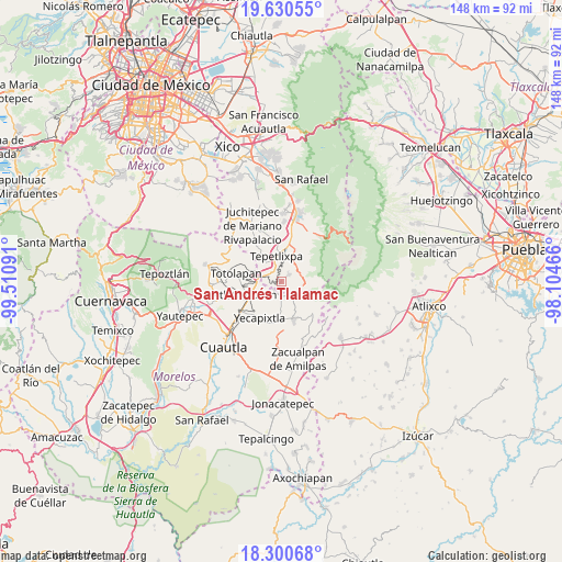
San Andrés Tlalamac GPS coordinates[2]
18° 58' 0.984" North, 98° 48' 28.008" West
| Map corner | latitude | longitude |
|---|---|---|
| Upper-left | 19.63055°, | -99.51091° |
| Center: | 18.96694°, | -98.80778° |
| Lower-right: | 18.30068°, | -98.10466° |
| Map W x H: | 147.9×147.9 km | = 91.9×91.9mi |
| max Lat: | 32.7° ⇑65.4% North |
| San Andrés Tlalamac: | 18.96694° |
| min Lat: | ⇓34.6% South 14.53588° |
| min Long | San Andrés Tla | max Long |
| -117.105° | -98.80778° | -86.73105° |
| W 53.5%⇐ | ⇒46.5% E |
Elevation
Elevation of San Andrés Tlalamac is 2073 m = 6801 ft, and this is 819.3 m = 2688 ft above average elevation for this country.
| Max E: |
3497 m = 11473 ft | 22.8% |
| San Andrés Tlalamac | 2073 m 6801 ft | |
| Avg. | 1253.7 m = 4113 ft | |
Min E: |
-1 m = -3 ft | 77.2% |
See also: Mexico elevation on elevation.city.
Geographical zone
San Andrés Tlalamac is located in North Torrid zone (between Equator and Tropic of Cancer). Distance of this Northern Tropic circle is 497 km =308.8 mi to North.| Distance of | km | miles | from San Andrés Tlalamac |
|---|---|---|---|
| North Pole | 7898.1 | 4907.7 | to North |
| Arctic Circle | 5292.2 | 3288.4 | to North |
| Tropic Cancer | 497 | 308.8 | to North |
| Equator | 2108.9 | 1310.4 | to South |


Nearby cities:
15 places around San Andrés Tlalamac: (largest is in red/bold)
• Achichipico
2.8 km =1.7 mi,  223°
223°
• Atlautla
6.8 km =4.2 mi,  26°
26°
• Colonia Guadalupe Hidalgo
0.8 km =0.5 mi,  288°
288°
• Cuecuecuatitla
6.4 km =4 mi,  324°
324°
• Ecatzingo de Hidalgo
6 km =3.7 mi,  102°
102°
• Huecahuasco
4.3 km =2.7 mi,  141°
141°
• Nepantla de Sor Juana Inés de la Cruz
3.8 km =2.4 mi, 293°
• Ocoxaltepec
6.8 km =4.2 mi,  121°
121°
• San José Tlacotitlán
2.1 km =1.3 mi,  4°
4°
• San Juan Tepecoculco
2.8 km =1.7 mi,  49°
49°
• San Juan Tlacotompa (Tlacotompa)
3.4 km =2.1 mi,  147°
147°
• San Marcos Tecomaxusco
5.2 km =3.2 mi,  71°
71°
• San Vicente Chimalhuacán
6.4 km =4 mi,  5°
5°
• Santiago Mamalhuazuca
3.5 km =2.2 mi,  20°
20°
• Texcala
3.9 km =2.4 mi,  159°
159°
Sources, notices
• [Note1] Compared only with cities in Mexico existing in our database
• [Src1] Map data: © OpenStreetMap contributors (CC-BY-SA)
• [Src2] Other city data from geonames.org with taken over terms of usage.
• [Src3] Geographical zone / Annual Mean Temperature by Robert A. Rohde @ Wikipedia
