Cuecuecuatitla geodata
Cuecuecuatitla (State of Mexico) is a populated place; located in Mexico in America/Mexico_City (GMT-6) time zone. With population of 1,869 people, there are 4645 cities with bigger population in this country. Compared to other cities in Mexico, 64.4% of cities are located further ↑North; 52.9% of cities are located further ←West and 85.7% of cities have lower elevation than Cuecuecuatitla. Note1


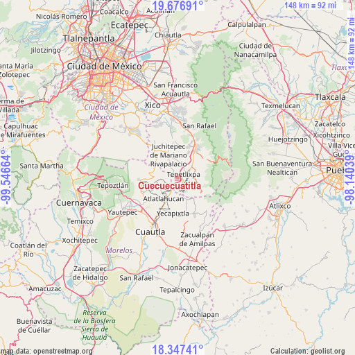
Cuecuecuatitla GPS coordinates[2]
19° 0' 48.564" North, 98° 50' 36.636" West
| Map corner | latitude | longitude |
|---|---|---|
| Upper-left | 19.67691°, | -99.54664° |
| Center: | 19.01349°, | -98.84351° |
| Lower-right: | 18.34741°, | -98.14039° |
| Map W x H: | 147.8×147.8 km | = 91.8×91.8mi |
| max Lat: | 32.7° ⇑64.4% North |
| Cuecuecuatitla: | 19.01349° |
| min Lat: | ⇓35.6% South 14.53588° |
| min Long | Cuecuecuatitla | max Long |
| -117.105° | -98.84351° | -86.73105° |
| W 52.9%⇐ | ⇒47.1% E |
Elevation
Elevation of Cuecuecuatitla is 2274 m = 7461 ft, and this is 1020.3 m = 3347 ft above average elevation for this country.
| Max E: |
3497 m = 11473 ft | 14.3% |
| Cuecuecuatitla | 2274 m 7461 ft | |
| Avg. | 1253.7 m = 4113 ft | |
Min E: |
-1 m = -3 ft | 85.7% |
See also: Mexico elevation on elevation.city.
Geographical zone
Cuecuecuatitla is located in North Torrid zone (between Equator and Tropic of Cancer). Distance of this Northern Tropic circle is 491.8 km =305.6 mi to North.| Distance of | km | miles | from Cuecuecuatitla |
|---|---|---|---|
| North Pole | 7893 | 4904.5 | to North |
| Arctic Circle | 5287.1 | 3285.3 | to North |
| Tropic Cancer | 491.8 | 305.6 | to North |
| Equator | 2114.1 | 1313.6 | to South |


Nearby cities:
15 places around Cuecuecuatitla: (largest is in red/bold)
• Achichipico
7.4 km =4.6 mi,  165°
165°
• Atlautla
6.9 km =4.3 mi,  82°
82°
• Colonia Guadalupe Hidalgo
5.8 km =3.6 mi,  148°
148°
• Nepantla de Sor Juana Inés de la Cruz
3.7 km =2.3 mi,  175°
175°
• Ozumba de Alzate
5.7 km =3.5 mi,  62°
62°
• Popo Park
8.7 km =5.4 mi,  48°
48°
• San Andrés Tlalamac
6.4 km =4 mi,  144°
144°
• San José Tlacotitlán
5 km =3.1 mi,  128°
128°
• San Juan Tepecoculco
6.8 km =4.2 mi,  119°
119°
• San Mateo Tecalco
6.7 km =4.2 mi, 48°
• San Matías Cuijingo
8 km =5 mi,  352°
352°
• San Vicente Chimalhuacán
4.5 km =2.8 mi, 75°
• Santiago Mamalhuazuca
5.3 km =3.3 mi,  110°
110°
• Tepetlixpa
2.9 km =1.8 mi, 53°
• Tlaltetelco (San Miguel Tlaltetelco)
8.3 km =5.2 mi,  214°
214°
Sources, notices
• [Note1] Compared only with cities in Mexico existing in our database
• [Src1] Map data: © OpenStreetMap contributors (CC-BY-SA)
• [Src2] Other city data from geonames.org with taken over terms of usage.
• [Src3] Geographical zone / Annual Mean Temperature by Robert A. Rohde @ Wikipedia
