San Juan Tlacotompa (Tlacotompa) geodata
San Juan Tlacotompa (Tlacotompa) (State of Mexico) is a populated place; located in Mexico in America/Mexico_City (GMT-6) time zone. With population of 1,193 people, there are 7278 cities with bigger population in this country. Compared to other cities in Mexico, 66% of cities are located further ↑North; 53.8% of cities are located further ←West and 77.7% of cities have lower elevation than San Juan Tlacotompa (Tlacotompa). Note1
Current local time in San Juan Tlacotompa (Tlacotompa):
10:21 AM, TuesdayDifference from your time zone: hours


San Juan Tlacotompa (Tlacotompa) GPS coordinates[2]
18° 56' 27.996" North, 98° 47' 26.016" West
| Map corner | latitude | longitude |
|---|---|---|
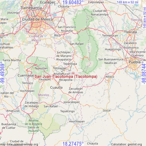
| Upper-left | 19.60482°, | -99.49369° |
| Center: | 18.94111°, | -98.79056° |
| Lower-right: | 18.27475°, | -98.08744° |
| Map W x H: | 147.9×147.9 km | = 91.9×91.9mi |
| max Lat: | 32.7° ⇑66% North |
| San Juan Tlacotompa (Tlacotompa): | 18.94111° |
| min Lat: | ⇓34% South 14.53588° |
| min Long | San Juan Tlacot | max Long |
| -117.105° | -98.79056° | -86.73105° |
| W 53.8%⇐ | ⇒46.2% E |
Elevation
Elevation of San Juan Tlacotompa (Tlacotompa) is 2082 m = 6831 ft, and this is 828.3 m = 2718 ft above average elevation for this country.
| Max E: |
3497 m = 11473 ft | 22.3% |
| San Juan Tlacotompa (Tlacotompa) | 2082 m 6831 ft | |
| Avg. | 1253.7 m = 4113 ft | |
Min E: |
-1 m = -3 ft | 77.7% |
See also: Mexico elevation on elevation.city.
Geographical zone
San Juan Tlacotompa (Tlacotompa) is located in North Torrid zone (between Equator and Tropic of Cancer). Distance of this Northern Tropic circle is 499.9 km =310.6 mi to North.| Distance of | km | miles | from San Juan Tlacotompa (Tlacotompa) |
|---|---|---|---|
| North Pole | 7901 | 4909.5 | to North |
| Arctic Circle | 5295.1 | 3290.2 | to North |
| Tropic Cancer | 499.9 | 310.6 | to North |
| Equator | 2106.1 | 1308.7 | to South |


Nearby cities:
15 places around San Juan Tlacotompa (Tlacotompa): (largest is in red/bold)
• Achichipico
3.8 km =2.4 mi,  282°
282°
• Colonia Guadalupe Hidalgo
4 km =2.5 mi,  320°
320°
• Ecatzingo de Hidalgo
4.3 km =2.7 mi,  69°
69°
• Huecahuasco
1 km =0.6 mi,  118°
118°
• Huejotengo (San Marcos)
6 km =3.7 mi,  140°
140°
• Huepalcalco (San Miguel)
5.6 km =3.5 mi,  130°
130°
• Jumiltepec
3.4 km =2.1 mi,  154°
154°
• Ocoxaltepec
4.1 km =2.5 mi,  99°
99°
• San Andrés Tlalamac
3.4 km =2.1 mi,  327°
327°
• San José Tlacotitlán
5.2 km =3.2 mi,  341°
341°
• San Juan Tepecoculco
4.7 km =2.9 mi,  3°
3°
• San Marcos Tecomaxusco
5.5 km =3.4 mi,  35°
35°
• Santiago Mamalhuazuca
6.2 km =3.9 mi,  354°
354°
• Texcala
0.9 km =0.6 mi,  210°
210°
• Xochitlán
6.3 km =3.9 mi,  201°
201°
Sources, notices
• [Note1] Compared only with cities in Mexico existing in our database
• [Src1] Map data: © OpenStreetMap contributors (CC-BY-SA)
• [Src2] Other city data from geonames.org with taken over terms of usage.
• [Src3] Geographical zone / Annual Mean Temperature by Robert A. Rohde @ Wikipedia
