Tiltepec geodata
Tiltepec (Hidalgo) is a populated place; located in Mexico in America/Mexico_City (GMT-6) time zone. With population of 1,272 people, there are 6810 cities with bigger population in this country. Compared to other cities in Mexico, 63.8% of cities are located further ↓South; 55.3% of cities are located further ←West and 74.4% of cities have lower elevation than Tiltepec. Note1


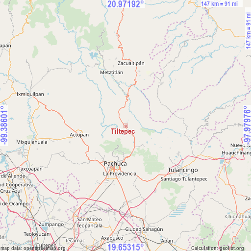
Tiltepec GPS coordinates[2]
20° 18' 50.184" North, 98° 40' 58.368" West
| Map corner | latitude | longitude |
|---|---|---|
| Upper-left | 20.97192°, | -99.38601° |
| Center: | 20.31394°, | -98.68288° |
| Lower-right: | 19.65315°, | -97.97976° |
| Map W x H: | 146.6×146.6 km | = 91.1×91.1mi |
| max Lat: | 32.7° ⇑36.2% North |
| Tiltepec: | 20.31394° |
| min Lat: | ⇓63.8% South 14.53588° |
| min Long | Tiltepec | max Long |
| -117.105° | -98.68288° | -86.73105° |
| W 55.3%⇐ | ⇒44.7% E |
Elevation
Elevation of Tiltepec is 2019 m = 6624 ft, and this is 765.3 m = 2511 ft above average elevation for this country.
| Max E: |
3497 m = 11473 ft | 25.6% |
| Tiltepec | 2019 m 6624 ft | |
| Avg. | 1253.7 m = 4113 ft | |
Min E: |
-1 m = -3 ft | 74.4% |
See also: Mexico elevation on elevation.city.
Geographical zone
Tiltepec is located in North Torrid zone (between Equator and Tropic of Cancer). Distance of this Northern Tropic circle is 347.2 km =215.7 mi to North.| Distance of | km | miles | from Tiltepec |
|---|---|---|---|
| North Pole | 7748.4 | 4814.6 | to North |
| Arctic Circle | 5142.5 | 3195.4 | to North |
| Tropic Cancer | 347.2 | 215.7 | to North |
| Equator | 2258.7 | 1403.5 | to South |


Nearby cities:
15 places around Tiltepec: (largest is in red/bold)
• Agua Limpia
9.2 km =5.7 mi,  150°
150°
• Apipilhuasco
6.9 km =4.3 mi,  106°
106°
• Atotonilco el Grande
3.4 km =2.1 mi, 153°
• Carboneras
11.2 km =7 mi,  186°
186°
• Cerro Colorado
11 km =6.8 mi,  340°
340°
• Cieneguillas
4.4 km =2.7 mi,  102°
102°
• La Estancia
1.8 km =1.1 mi,  202°
202°
• La Puebla
4.5 km =2.8 mi,  161°
161°
• Los Sabinos
3.6 km =2.2 mi,  87°
87°
• Montecillos
8.4 km =5.2 mi, 109°
• Ojo de Agua
11.1 km =6.9 mi,  132°
132°
• San Martín
6.5 km =4 mi,  24°
24°
• Santa María Amajac
6.4 km =4 mi,  280°
280°
• Santo Tomás Allende
11.3 km =7 mi,  143°
143°
• Venta de Guadalupe
11.6 km =7.2 mi, 157°
Sources, notices
• [Note1] Compared only with cities in Mexico existing in our database
• [Src1] Map data: © OpenStreetMap contributors (CC-BY-SA)
• [Src2] Other city data from geonames.org with taken over terms of usage.
• [Src3] Geographical zone / Annual Mean Temperature by Robert A. Rohde @ Wikipedia
