Montecillos geodata
Montecillos (Hidalgo) is a populated place; located in Mexico in America/Mexico_City (GMT-6) time zone. With population of 915 people, there are 9537 cities with bigger population in this country. Compared to other cities in Mexico, 63.3% of cities are located further ↓South; 56% of cities are located further ←West and 75.3% of cities have lower elevation than Montecillos. Note1


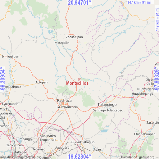
Montecillos GPS coordinates[2]
20° 17' 20.148" North, 98° 36' 23.076" West
| Map corner | latitude | longitude |
|---|---|---|
| Upper-left | 20.94701°, | -99.30954° |
| Center: | 20.28893°, | -98.60641° |
| Lower-right: | 19.62804°, | -97.90329° |
| Map W x H: | 146.7×146.7 km | = 91.2×91.2mi |
| max Lat: | 32.7° ⇑36.7% North |
| Montecillos: | 20.28893° |
| min Lat: | ⇓63.3% South 14.53588° |
| min Long | Montecillos | max Long |
| -117.105° | -98.60641° | -86.73105° |
| W 56%⇐ | ⇒44% E |
Elevation
Elevation of Montecillos is 2036 m = 6680 ft, and this is 782.3 m = 2567 ft above average elevation for this country.
| Max E: |
3497 m = 11473 ft | 24.7% |
| Montecillos | 2036 m 6680 ft | |
| Avg. | 1253.7 m = 4113 ft | |
Min E: |
-1 m = -3 ft | 75.3% |
See also: Mexico elevation on elevation.city.
Geographical zone
Montecillos is located in North Torrid zone (between Equator and Tropic of Cancer). Distance of this Northern Tropic circle is 350 km =217.5 mi to North.| Distance of | km | miles | from Montecillos |
|---|---|---|---|
| North Pole | 7751.1 | 4816.3 | to North |
| Arctic Circle | 5145.3 | 3197.1 | to North |
| Tropic Cancer | 350 | 217.5 | to North |
| Equator | 2255.9 | 1401.8 | to South |


Nearby cities:
15 places around Montecillos: (largest is in red/bold)
• Agua Limpia
6.3 km =3.9 mi,  213°
213°
• Apipilhuasco
1.6 km =1 mi,  303°
303°
• Atotonilco el Grande
6.5 km =4 mi,  267°
267°
• Cieneguillas
4.1 km =2.5 mi, 295°
• Huasca de Ocampo
10 km =6.2 mi,  161°
161°
• La Estancia
8.7 km =5.4 mi,  277°
277°
• La Loma
8.6 km =5.3 mi, 162°
• La Puebla
6.7 km =4.2 mi,  257°
257°
• Los Sabinos
5.3 km =3.3 mi, 303°
• Ojo de Agua
4.7 km =2.9 mi,  177°
177°
• San José Ocotillos
9.2 km =5.7 mi, 184°
• San Miguel Regla
9.1 km =5.7 mi,  148°
148°
• Santo Tomás Allende
6.4 km =4 mi,  191°
191°
• Tiltepec
8.4 km =5.2 mi,  289°
289°
• Venta de Guadalupe
8.7 km =5.4 mi,  204°
204°
Sources, notices
• [Note1] Compared only with cities in Mexico existing in our database
• [Src1] Map data: © OpenStreetMap contributors (CC-BY-SA)
• [Src2] Other city data from geonames.org with taken over terms of usage.
• [Src3] Geographical zone / Annual Mean Temperature by Robert A. Rohde @ Wikipedia
