Santo Tomás Allende geodata
Santo Tomás Allende (Hidalgo) is a populated place; located in Mexico in America/Mexico_City (GMT-6) time zone. With population of 964 people, there are 9028 cities with bigger population in this country. Compared to other cities in Mexico, 62.1% of cities are located further ↓South; 55.9% of cities are located further ←West and 85.7% of cities have lower elevation than Santo Tomás Allende. Note1


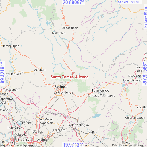
Santo Tomás Allende GPS coordinates[2]
20° 13' 56.424" North, 98° 37' 7.608" West
| Map corner | latitude | longitude |
|---|---|---|
| Upper-left | 20.89067°, | -99.32191° |
| Center: | 20.23234°, | -98.61878° |
| Lower-right: | 19.57121°, | -97.91566° |
| Map W x H: | 146.7×146.7 km | = 91.2×91.2mi |
| max Lat: | 32.7° ⇑37.9% North |
| Santo Tomás Allende: | 20.23234° |
| min Lat: | ⇓62.1% South 14.53588° |
| min Long | Santo Tomás Al | max Long |
| -117.105° | -98.61878° | -86.73105° |
| W 55.9%⇐ | ⇒44.1% E |
Elevation
Elevation of Santo Tomás Allende is 2273 m = 7457 ft, and this is 1019.3 m = 3344 ft above average elevation for this country.
| Max E: |
3497 m = 11473 ft | 14.3% |
| Santo Tomás Allende | 2273 m 7457 ft | |
| Avg. | 1253.7 m = 4113 ft | |
Min E: |
-1 m = -3 ft | 85.7% |
See also: Mexico elevation on elevation.city.
Geographical zone
Santo Tomás Allende is located in North Torrid zone (between Equator and Tropic of Cancer). Distance of this Northern Tropic circle is 356.3 km =221.4 mi to North.| Distance of | km | miles | from Santo Tomás Allende |
|---|---|---|---|
| North Pole | 7757.4 | 4820.2 | to North |
| Arctic Circle | 5151.5 | 3201 | to North |
| Tropic Cancer | 356.3 | 221.4 | to North |
| Equator | 2249.6 | 1397.8 | to South |


Nearby cities:
15 places around Santo Tomás Allende: (largest is in red/bold)
• Agua Limpia
2.4 km =1.5 mi,  296°
296°
• Apipilhuasco
7.2 km =4.5 mi,  359°
359°
• Atotonilco el Grande
7.9 km =4.9 mi,  319°
319°
• Carboneras
8.2 km =5.1 mi,  255°
255°
• Cieneguillas
8.5 km =5.3 mi,  343°
343°
• Huasca de Ocampo
5.5 km =3.4 mi,  125°
125°
• La Loma
4.3 km =2.7 mi,  116°
116°
• La Puebla
7.1 km =4.4 mi,  312°
312°
• Montecillos
6.4 km =4 mi,  11°
11°
• Ojo de Agua
2.2 km =1.4 mi,  43°
43°
• Omitlán de Juárez
7.6 km =4.7 mi,  203°
203°
• San José Ocotillos
2.9 km =1.8 mi,  168°
168°
• San Miguel Regla
6.2 km =3.9 mi,  103°
103°
• Velasco
6.6 km =4.1 mi, 200°
• Venta de Guadalupe
2.9 km =1.8 mi,  235°
235°
Sources, notices
• [Note1] Compared only with cities in Mexico existing in our database
• [Src1] Map data: © OpenStreetMap contributors (CC-BY-SA)
• [Src2] Other city data from geonames.org with taken over terms of usage.
• [Src3] Geographical zone / Annual Mean Temperature by Robert A. Rohde @ Wikipedia
