Tepotzotlán geodata
Tepotzotlán (State of Mexico) is a seat of a second-order administrative division; located in Mexico in America/Mexico_City (GMT-6) time zone. With population of 38,119 people, there are 273 cities with bigger population in this country. Compared to other cities in Mexico, 51% of cities are located further ↓South; 53.2% of cities are located further →East and 87.2% of cities have lower elevation than Tepotzotlán. Note1


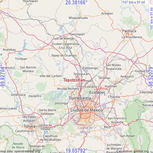
Tepotzotlán GPS coordinates[2]
19° 43' 16.176" North, 99° 13' 26.076" West
| Map corner | latitude | longitude |
|---|---|---|
| Upper-left | 20.38166°, | -99.92704° |
| Center: | 19.72116°, | -99.22391° |
| Lower-right: | 19.05792°, | -98.52079° |
| Map W x H: | 147.2×147.2 km | = 91.5×91.5mi |
| max Lat: | 32.7° ⇑49% North |
| Tepotzotlán: | 19.72116° |
| min Lat: | ⇓51% South 14.53588° |
| min Long | Tepotzotlán | max Long |
| -117.105° | -99.22391° | -86.73105° |
| W 46.8%⇐ | ⇒53.2% E |
Elevation
Elevation of Tepotzotlán is 2317 m = 7602 ft, and this is 1063.3 m = 3489 ft above average elevation for this country.
| Max E: |
3497 m = 11473 ft | 12.8% |
| Tepotzotlán | 2317 m 7602 ft | |
| Avg. | 1253.7 m = 4113 ft | |
Min E: |
-1 m = -3 ft | 87.2% |
See also: Mexico elevation on elevation.city.
Geographical zone
Tepotzotlán is located in North Torrid zone (between Equator and Tropic of Cancer). Distance of this Northern Tropic circle is 413.1 km =256.7 mi to North.| Distance of | km | miles | from Tepotzotlán |
|---|---|---|---|
| North Pole | 7814.3 | 4855.6 | to North |
| Arctic Circle | 5208.4 | 3236.3 | to North |
| Tropic Cancer | 413.1 | 256.7 | to North |
| Equator | 2192.8 | 1362.5 | to South |


Nearby cities:
15 places around Tepotzotlán: (largest is in red/bold)
• Ampliación los Potros (Tres Piedras)
2.1 km =1.3 mi,  314°
314°
• Axotlán
3.4 km =2.1 mi,  208°
208°
• Barrio Tlatenco
3.9 km =2.4 mi,  59°
59°
• Barrio la Tecla
4.6 km =2.9 mi,  354°
354°
• Colonia Guadalupe
2.8 km =1.7 mi,  251°
251°
• Ejido Santiago
4.9 km =3 mi,  241°
241°
• El Cerrito
5.6 km =3.5 mi,  228°
228°
• Lumbrera Número Diez
1.1 km =0.7 mi,  356°
356°
• San José del Puente
2.9 km =1.8 mi,  91°
91°
• San Mateo Xoloc
3 km =1.9 mi, 237°
• San Pablo de los Gallos
5.4 km =3.4 mi, 205°
• San Sebastián
3.5 km =2.2 mi,  16°
16°
• Santa Cruz
4.8 km =3 mi, 233°
• Santa Cruz del Monte
5.1 km =3.2 mi, 354°
• Teoloyucan
5.2 km =3.2 mi, 60°
Sources, notices
• [Note1] Compared only with cities in Mexico existing in our database
• [Src1] Map data: © OpenStreetMap contributors (CC-BY-SA)
• [Src2] Other city data from geonames.org with taken over terms of usage.
• [Src3] Geographical zone / Annual Mean Temperature by Robert A. Rohde @ Wikipedia
