Barrio la Tecla geodata
Barrio la Tecla (State of Mexico) is a populated place; located in Mexico in America/Mexico_City (GMT-6) time zone. With population of 565 people, there are 15122 cities with bigger population in this country. Compared to other cities in Mexico, 51.7% of cities are located further ↓South; 53.3% of cities are located further →East and 87.3% of cities have lower elevation than Barrio la Tecla. Note1


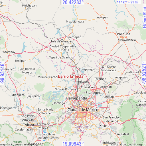
Barrio la Tecla GPS coordinates[2]
19° 45' 45" North, 99° 13' 41.988" West
| Map corner | latitude | longitude |
|---|---|---|
| Upper-left | 20.42283°, | -99.93146° |
| Center: | 19.7625°, | -99.22833° |
| Lower-right: | 19.09943°, | -98.52521° |
| Map W x H: | 147.1×147.2 km | = 91.4×91.5mi |
| max Lat: | 32.7° ⇑48.3% North |
| Barrio la Tecla: | 19.7625° |
| min Lat: | ⇓51.7% South 14.53588° |
| min Long | Barrio la Tecla | max Long |
| -117.105° | -99.22833° | -86.73105° |
| W 46.7%⇐ | ⇒53.3% E |
Elevation
Elevation of Barrio la Tecla is 2318 m = 7605 ft, and this is 1064.3 m = 3492 ft above average elevation for this country.
| Max E: |
3497 m = 11473 ft | 12.7% |
| Barrio la Tecla | 2318 m 7605 ft | |
| Avg. | 1253.7 m = 4113 ft | |
Min E: |
-1 m = -3 ft | 87.3% |
See also: Mexico elevation on elevation.city.
Geographical zone
Barrio la Tecla is located in North Torrid zone (between Equator and Tropic of Cancer). Distance of this Northern Tropic circle is 408.5 km =253.8 mi to North.| Distance of | km | miles | from Barrio la Tecla |
|---|---|---|---|
| North Pole | 7809.7 | 4852.7 | to North |
| Arctic Circle | 5203.8 | 3233.5 | to North |
| Tropic Cancer | 408.5 | 253.8 | to North |
| Equator | 2197.4 | 1365.4 | to South |


Nearby cities:
15 places around Barrio la Tecla: (largest is in red/bold)
• Ampliación los Potros (Tres Piedras)
3.3 km =2.1 mi,  197°
197°
• Barrio Tlatenco
4.6 km =2.9 mi,  124°
124°
• Colonia Guadalupe
5.9 km =3.7 mi, 202°
• Coyotepec
2.3 km =1.4 mi,  44°
44°
• El Ramal (Las Ladrilleras)
4.5 km =2.8 mi,  86°
86°
• Jorobas
7.1 km =4.4 mi,  342°
342°
• La Planada
5.2 km =3.2 mi,  66°
66°
• Lumbrera Número Diez
3.5 km =2.2 mi,  173°
173°
• San José del Puente
5.7 km =3.5 mi,  144°
144°
• San Mateo Xoloc
6.6 km =4.1 mi, 198°
• San Sebastián
1.9 km =1.2 mi,  131°
131°
• Santa Cruz del Monte
0.5 km =0.3 mi,  355°
355°
• Segunda Sección del Barrio de Santiago
1.3 km =0.8 mi,  2°
2°
• Teoloyucan
5.3 km =3.3 mi,  112°
112°
• Tepotzotlán
4.6 km =2.9 mi, 174°
Sources, notices
• [Note1] Compared only with cities in Mexico existing in our database
• [Src1] Map data: © OpenStreetMap contributors (CC-BY-SA)
• [Src2] Other city data from geonames.org with taken over terms of usage.
• [Src3] Geographical zone / Annual Mean Temperature by Robert A. Rohde @ Wikipedia
