Los Reyes Teolco geodata
Los Reyes Teolco (Puebla) is a populated place; located in Mexico in America/Mexico_City (GMT-6) time zone. With population of 910 people, there are 9586 cities with bigger population in this country. Compared to other cities in Mexico, 69.7% of cities are located further ↑North; 55.2% of cities are located further ←West and 59.2% of cities have lower elevation than Los Reyes Teolco. Note1


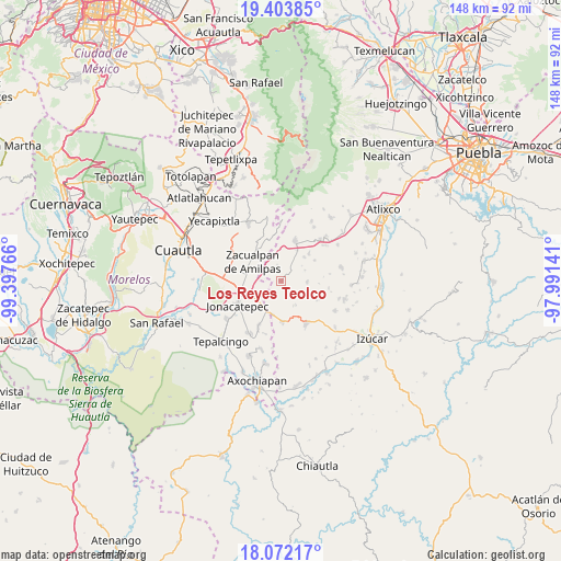
Los Reyes Teolco GPS coordinates[2]
18° 44' 21.552" North, 98° 41' 40.308" West
| Map corner | latitude | longitude |
|---|---|---|
| Upper-left | 19.40385°, | -99.39766° |
| Center: | 18.73932°, | -98.69453° |
| Lower-right: | 18.07217°, | -97.99141° |
| Map W x H: | 148.1×148.1 km | = 92×92mi |
| max Lat: | 32.7° ⇑69.7% North |
| Los Reyes Teolco: | 18.73932° |
| min Lat: | ⇓30.3% South 14.53588° |
| min Long | Los Reyes Teolc | max Long |
| -117.105° | -98.69453° | -86.73105° |
| W 55.2%⇐ | ⇒44.8% E |
Elevation
Elevation of Los Reyes Teolco is 1713 m = 5620 ft, and this is 459.3 m = 1507 ft above average elevation for this country.
| Max E: |
3497 m = 11473 ft | 40.8% |
| Los Reyes Teolco | 1713 m 5620 ft | |
| Avg. | 1253.7 m = 4113 ft | |
Min E: |
-1 m = -3 ft | 59.2% |
See also: Mexico elevation on elevation.city.
Geographical zone
Los Reyes Teolco is located in North Torrid zone (between Equator and Tropic of Cancer). Distance of this Northern Tropic circle is 522.3 km =324.5 mi to North.| Distance of | km | miles | from Los Reyes Teolco |
|---|---|---|---|
| North Pole | 7923.4 | 4923.4 | to North |
| Arctic Circle | 5317.6 | 3304.2 | to North |
| Tropic Cancer | 522.3 | 324.5 | to North |
| Equator | 2083.6 | 1294.7 | to South |


Nearby cities:
15 places around Los Reyes Teolco: (largest is in red/bold)
• Acteopan
3.4 km =2.1 mi,  323°
323°
• Amilcingo
8 km =5 mi,  272°
272°
• Chalcatzingo
10.1 km =6.3 mi,  236°
236°
• Cohuecán
5.6 km =3.5 mi,  330°
330°
• Huazulco
8.6 km =5.3 mi,  280°
280°
• Jantetelco
9.1 km =5.7 mi,  255°
255°
• Popotlán (Barrio Santo Tomás)
8 km =5 mi,  290°
290°
• San Felipe Cuapexco
9.2 km =5.7 mi,  353°
353°
• San Felipe Tepemaxalco
6.7 km =4.2 mi,  92°
92°
• San Felipe Toctla
2.5 km =1.6 mi, 347°
• San Mateo Coatepec
9.1 km =5.7 mi,  27°
27°
• San Pedro Ixhuatepec
8.7 km =5.4 mi,  44°
44°
• Temoac
9.5 km =5.9 mi, 292°
• Tlacotepec
9.9 km =6.2 mi, 327°
• Zacualpan de Amilpas
9 km =5.6 mi,  303°
303°
Sources, notices
• [Note1] Compared only with cities in Mexico existing in our database
• [Src1] Map data: © OpenStreetMap contributors (CC-BY-SA)
• [Src2] Other city data from geonames.org with taken over terms of usage.
• [Src3] Geographical zone / Annual Mean Temperature by Robert A. Rohde @ Wikipedia
