Chalcatzingo geodata
Chalcatzingo (Morelos) is a populated place; located in Mexico in America/Mexico_City (GMT-6) time zone. With population of 2,449 people, there are 3605 cities with bigger population in this country. Compared to other cities in Mexico, 70.3% of cities are located further ↑North; 54% of cities are located further ←West and 51.2% of cities have higher elevation than Chalcatzingo. Note1


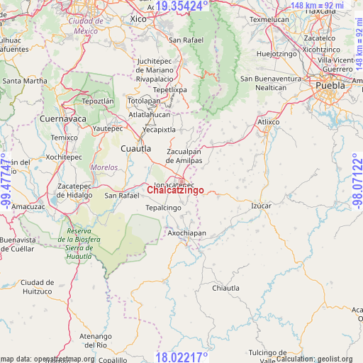
Chalcatzingo GPS coordinates[2]
18° 41' 22.236" North, 98° 46' 27.624" West
| Map corner | latitude | longitude |
|---|---|---|
| Upper-left | 19.35424°, | -99.47747° |
| Center: | 18.68951°, | -98.77434° |
| Lower-right: | 18.02217°, | -98.07122° |
| Map W x H: | 148.1×148.1 km | = 92×92mi |
| max Lat: | 32.7° ⇑70.3% North |
| Chalcatzingo: | 18.68951° |
| min Lat: | ⇓29.7% South 14.53588° |
| min Long | Chalcatzingo | max Long |
| -117.105° | -98.77434° | -86.73105° |
| W 54%⇐ | ⇒46% E |
Elevation
Elevation of Chalcatzingo is 1372 m = 4501 ft, and this is 118.3 m = 388 ft above average elevation for this country.
| Max E: |
3497 m = 11473 ft | 51.2% |
| Chalcatzingo | 1372 m 4501 ft | |
| Avg. | 1253.7 m = 4113 ft | |
Min E: |
-1 m = -3 ft | 48.8% |
See also: Mexico elevation on elevation.city.
Geographical zone
Chalcatzingo is located in North Torrid zone (between Equator and Tropic of Cancer). Distance of this Northern Tropic circle is 527.8 km =328 mi to North.| Distance of | km | miles | from Chalcatzingo |
|---|---|---|---|
| North Pole | 7929 | 4926.9 | to North |
| Arctic Circle | 5323.1 | 3307.6 | to North |
| Tropic Cancer | 527.8 | 328 | to North |
| Equator | 2078.1 | 1291.3 | to South |


Nearby cities:
15 places around Chalcatzingo: (largest is in red/bold)
• Amacuitlapilco
4 km =2.5 mi,  280°
280°
• Amayuca
4.6 km =2.9 mi,  326°
326°
• Amilcingo
5.9 km =3.7 mi,  3°
3°
• Atotonilco
7.5 km =4.7 mi,  233°
233°
• Huazulco
7.1 km =4.4 mi,  359°
359°
• Jantetelco
3.2 km =2 mi,  353°
353°
• Jonacatepec
3.2 km =2 mi,  252°
252°
• Los Reyes Teolco
10.1 km =6.3 mi,  56°
56°
• Popotlán (Barrio Santo Tomás)
8.4 km =5.2 mi,  6°
6°
• Temoac
9.2 km =5.7 mi, 357°
• Tenango
7.8 km =4.8 mi,  162°
162°
• Tepexco
10.3 km =6.4 mi,  121°
121°
• Tetelilla
8.5 km =5.3 mi,  179°
179°
• Unidad Habitacional Mariano Matamoros
10.4 km =6.5 mi,  308°
308°
• Zacualpan de Amilpas
10.5 km =6.5 mi, 4°
Sources, notices
• [Note1] Compared only with cities in Mexico existing in our database
• [Src1] Map data: © OpenStreetMap contributors (CC-BY-SA)
• [Src2] Other city data from geonames.org with taken over terms of usage.
• [Src3] Geographical zone / Annual Mean Temperature by Robert A. Rohde @ Wikipedia
