Pino Suárez geodata
Pino Suárez (Hidalgo) is a populated place; located in Mexico in America/Mexico_City (GMT-6) time zone. With population of 1,073 people, there are 8130 cities with bigger population in this country. Compared to other cities in Mexico, 62.4% of cities are located further ↓South; 55.9% of cities are located further →East and 82.5% of cities have lower elevation than Pino Suárez. Note1


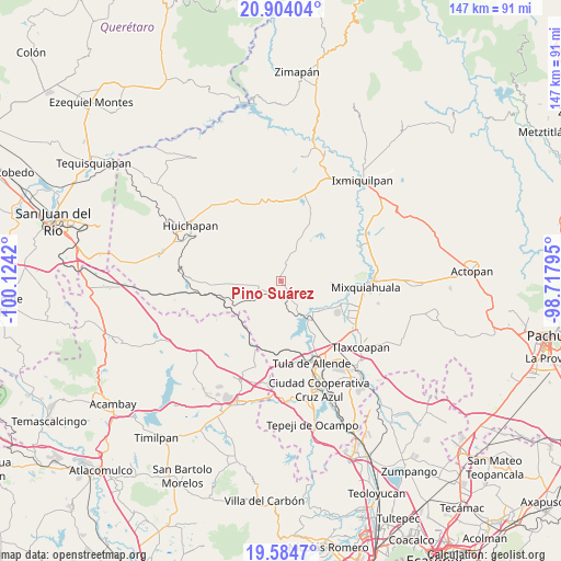
Pino Suárez GPS coordinates[2]
20° 14' 44.772" North, 99° 25' 15.852" West
| Map corner | latitude | longitude |
|---|---|---|
| Upper-left | 20.90404°, | -100.1242° |
| Center: | 20.24577°, | -99.42107° |
| Lower-right: | 19.5847°, | -98.71795° |
| Map W x H: | 146.7×146.7 km | = 91.2×91.2mi |
| max Lat: | 32.7° ⇑37.6% North |
| Pino Suárez: | 20.24577° |
| min Lat: | ⇓62.4% South 14.53588° |
| min Long | Pino Suárez | max Long |
| -117.105° | -99.42107° | -86.73105° |
| W 44.1%⇐ | ⇒55.9% E |
Elevation
Elevation of Pino Suárez is 2200 m = 7218 ft, and this is 946.3 m = 3105 ft above average elevation for this country.
| Max E: |
3497 m = 11473 ft | 17.5% |
| Pino Suárez | 2200 m 7218 ft | |
| Avg. | 1253.7 m = 4113 ft | |
Min E: |
-1 m = -3 ft | 82.5% |
See also: Mexico elevation on elevation.city.
Geographical zone
Pino Suárez is located in North Torrid zone (between Equator and Tropic of Cancer). Distance of this Northern Tropic circle is 354.8 km =220.5 mi to North.| Distance of | km | miles | from Pino Suárez |
|---|---|---|---|
| North Pole | 7755.9 | 4819.3 | to North |
| Arctic Circle | 5150.1 | 3200.1 | to North |
| Tropic Cancer | 354.8 | 220.5 | to North |
| Equator | 2251.1 | 1398.8 | to South |


Nearby cities:
15 places around Pino Suárez: (largest is in red/bold)
• Atengo
12.6 km =7.8 mi,  128°
128°
• Chapantongo
4.6 km =2.9 mi,  10°
10°
• Colonia Ampliación (Segunda Manzana)
8.2 km =5.1 mi,  141°
141°
• General Pedro María Anaya
12.6 km =7.8 mi, 142°
• José María Pino Suárez
0.2 km =0.1 mi,  358°
358°
• La Cuarta Manzana
7.6 km =4.7 mi,  154°
154°
• La Loma
9.5 km =5.9 mi, 152°
• San Bartolo Ozocalpan
7.5 km =4.7 mi,  250°
250°
• San Gabriel
12.2 km =7.6 mi, 132°
• San Juan El Sabino
10.5 km =6.5 mi,  27°
27°
• San Pablo Oxtotipan
11.5 km =7.1 mi,  23°
23°
• San Pedro Nextlalpan
11 km =6.8 mi,  161°
161°
• Tepetitlan
7.8 km =4.8 mi, 147°
• Xiteje de la Reforma
13.3 km =8.3 mi,  210°
210°
• Zimapantongo
3.6 km =2.2 mi,  258°
258°
Sources, notices
• [Note1] Compared only with cities in Mexico existing in our database
• [Src1] Map data: © OpenStreetMap contributors (CC-BY-SA)
• [Src2] Other city data from geonames.org with taken over terms of usage.
• [Src3] Geographical zone / Annual Mean Temperature by Robert A. Rohde @ Wikipedia
