La Cuarta Manzana geodata
La Cuarta Manzana (Hidalgo) is a populated place; located in Mexico in America/Mexico_City (GMT-6) time zone. With population of 583 people, there are 14713 cities with bigger population in this country. Compared to other cities in Mexico, 61% of cities are located further ↓South; 55.5% of cities are located further →East and 76% of cities have lower elevation than La Cuarta Manzana. Note1


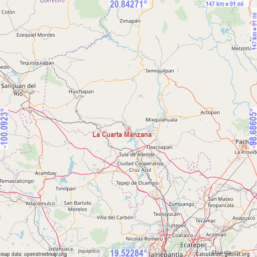
La Cuarta Manzana GPS coordinates[2]
20° 11' 3.012" North, 99° 23' 21.012" West
| Map corner | latitude | longitude |
|---|---|---|
| Upper-left | 20.84271°, | -100.0923° |
| Center: | 20.18417°, | -99.38917° |
| Lower-right: | 19.52284°, | -98.68605° |
| Map W x H: | 146.8×146.8 km | = 91.2×91.2mi |
| max Lat: | 32.7° ⇑39% North |
| La Cuarta Manzana: | 20.18417° |
| min Lat: | ⇓61% South 14.53588° |
| min Long | La Cuarta Manza | max Long |
| -117.105° | -99.38917° | -86.73105° |
| W 44.5%⇐ | ⇒55.5% E |
Elevation
Elevation of La Cuarta Manzana is 2048 m = 6719 ft, and this is 794.3 m = 2606 ft above average elevation for this country.
| Max E: |
3497 m = 11473 ft | 24% |
| La Cuarta Manzana | 2048 m 6719 ft | |
| Avg. | 1253.7 m = 4113 ft | |
Min E: |
-1 m = -3 ft | 76% |
See also: Mexico elevation on elevation.city.
Geographical zone
La Cuarta Manzana is located in North Torrid zone (between Equator and Tropic of Cancer). Distance of this Northern Tropic circle is 361.6 km =224.7 mi to North.| Distance of | km | miles | from La Cuarta Manzana |
|---|---|---|---|
| North Pole | 7762.8 | 4823.6 | to North |
| Arctic Circle | 5156.9 | 3204.3 | to North |
| Tropic Cancer | 361.6 | 224.7 | to North |
| Equator | 2244.3 | 1394.5 | to South |


Nearby cities:
15 places around La Cuarta Manzana: (largest is in red/bold)
• Atengo
6.5 km =4 mi,  98°
98°
• Colonia Ampliación (Segunda Manzana)
1.8 km =1.1 mi,  77°
77°
• Colonia Benito Juárez
10.1 km =6.3 mi,  149°
149°
• General Pedro María Anaya
5.3 km =3.3 mi,  126°
126°
• José María Pino Suárez
7.8 km =4.8 mi,  334°
334°
• La Loma
1.9 km =1.2 mi, 146°
• Pino Suárez
7.6 km =4.7 mi, 334°
• San Gabriel
5.8 km =3.6 mi, 103°
• San Juan Achichilco
7.8 km =4.8 mi,  94°
94°
• San Pedro Nextlalpan
3.6 km =2.2 mi,  177°
177°
• Santa Ana Ahuehuepan
8.2 km =5.1 mi, 145°
• Santiago Acayutlán
9.9 km =6.2 mi, 81°
• Tepetitlan
1 km =0.6 mi,  69°
69°
• Xiteje de Zapata
9.7 km =6 mi, 179°
• Zimapantongo
9.2 km =5.7 mi,  311°
311°
Sources, notices
• [Note1] Compared only with cities in Mexico existing in our database
• [Src1] Map data: © OpenStreetMap contributors (CC-BY-SA)
• [Src2] Other city data from geonames.org with taken over terms of usage.
• [Src3] Geographical zone / Annual Mean Temperature by Robert A. Rohde @ Wikipedia
