San Sebastián de Las Barrancas Sur geodata
San Sebastián de Las Barrancas Sur (Querétaro) is a populated place; located in Mexico in America/Mexico_City (GMT-6) time zone. With population of 1,173 people, there are 7403 cities with bigger population in this country. Compared to other cities in Mexico, 62.8% of cities are located further ↓South; 63.1% of cities are located further →East and 82.5% of cities have lower elevation than San Sebastián de Las Barrancas Sur. Note1
Current local time in San Sebastián de Las Barrancas Sur:
07:19 AM, MondayDifference from your time zone: hours


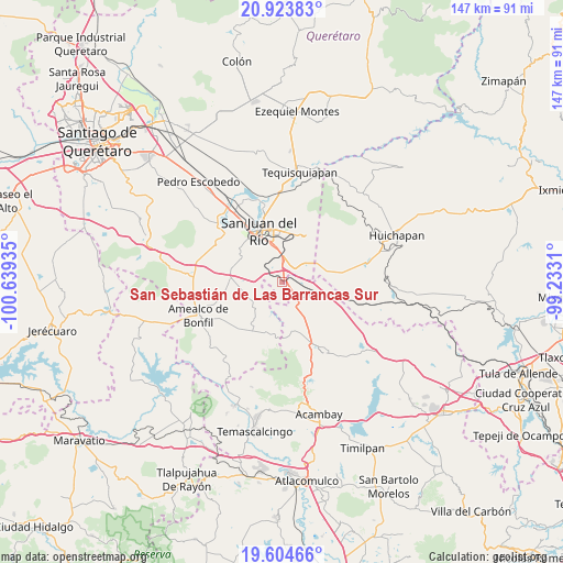
San Sebastián de Las Barrancas Sur GPS coordinates[2]
20° 15' 56.34" North, 99° 56' 10.392" West
| Map corner | latitude | longitude |
|---|---|---|
| Upper-left | 20.92383°, | -100.63935° |
| Center: | 20.26565°, | -99.93622° |
| Lower-right: | 19.60466°, | -99.2331° |
| Map W x H: | 146.7×146.7 km | = 91.2×91.2mi |
| max Lat: | 32.7° ⇑37.2% North |
| San Sebastián de Las Barrancas Sur: | 20.26565° |
| min Lat: | ⇓62.8% South 14.53588° |
| min Long | San Sebastián | max Long |
| -117.105° | -99.93622° | -86.73105° |
| W 36.9%⇐ | ⇒63.1% E |
Elevation
Elevation of San Sebastián de Las Barrancas Sur is 2203 m = 7228 ft, and this is 949.3 m = 3115 ft above average elevation for this country.
| Max E: |
3497 m = 11473 ft | 17.5% |
| San Sebastián de Las Barrancas Sur | 2203 m 7228 ft | |
| Avg. | 1253.7 m = 4113 ft | |
Min E: |
-1 m = -3 ft | 82.5% |
See also: Mexico elevation on elevation.city.
Geographical zone
San Sebastián de Las Barrancas Sur is located in North Torrid zone (between Equator and Tropic of Cancer). Distance of this Northern Tropic circle is 352.6 km =219.1 mi to North.| Distance of | km | miles | from San Sebastián de Las Barrancas Sur |
|---|---|---|---|
| North Pole | 7753.7 | 4817.9 | to North |
| Arctic Circle | 5147.8 | 3198.7 | to North |
| Tropic Cancer | 352.6 | 219.1 | to North |
| Equator | 2253.3 | 1400.1 | to South |


Nearby cities:
15 places around San Sebastián de Las Barrancas Sur: (largest is in red/bold)
• Barrio Lázaro Cárdenas (San Rafael)
10.7 km =6.6 mi,  100°
100°
• Celayita
8.3 km =5.2 mi,  109°
109°
• El Cazadero
7.7 km =4.8 mi,  60°
60°
• El Mogote
11.3 km =7 mi,  168°
168°
• El Rodeo
10.4 km =6.5 mi,  335°
335°
• El Tesoro
7 km =4.3 mi, 103°
• Lázaro Cárdenas (1ra. Sección del Rodeo)
11.3 km =7 mi, 335°
• Palmillas
7.9 km =4.9 mi,  356°
356°
• Paso de Mata
8.6 km =5.3 mi,  6°
6°
• Puerta de Palmillas
5.6 km =3.5 mi,  21°
21°
• San Francisco
10 km =6.2 mi,  346°
346°
• San Pedro Denxhi Centro
3.7 km =2.3 mi,  242°
242°
• San Pedro Denxhi Segundo Cuartel
5 km =3.1 mi,  209°
209°
• Santa Bárbara de La Cueva
4.4 km =2.7 mi,  320°
320°
• Yosphí
10.7 km =6.6 mi,  188°
188°
Sources, notices
• [Note1] Compared only with cities in Mexico existing in our database
• [Src1] Map data: © OpenStreetMap contributors (CC-BY-SA)
• [Src2] Other city data from geonames.org with taken over terms of usage.
• [Src3] Geographical zone / Annual Mean Temperature by Robert A. Rohde @ Wikipedia
