Yosphí geodata
Yosphí (Querétaro) is a populated place; located in Mexico in America/Mexico_City (GMT-6) time zone. With population of 1,386 people, there are 6243 cities with bigger population in this country. Compared to other cities in Mexico, 60.7% of cities are located further ↓South; 63.3% of cities are located further →East and 88.9% of cities have lower elevation than Yosphí. Note1


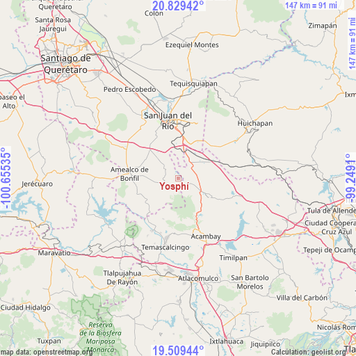
Yosphí GPS coordinates[2]
20° 10' 14.988" North, 99° 57' 7.992" West
| Map corner | latitude | longitude |
|---|---|---|
| Upper-left | 20.82942°, | -100.65535° |
| Center: | 20.17083°, | -99.95222° |
| Lower-right: | 19.50944°, | -99.2491° |
| Map W x H: | 146.8×146.8 km | = 91.2×91.2mi |
| max Lat: | 32.7° ⇑39.3% North |
| Yosphí: | 20.17083° |
| min Lat: | ⇓60.7% South 14.53588° |
| min Long | Yosphí | max Long |
| -117.105° | -99.95222° | -86.73105° |
| W 36.7%⇐ | ⇒63.3% E |
Elevation
Elevation of Yosphí is 2368 m = 7769 ft, and this is 1114.3 m = 3656 ft above average elevation for this country.
| Max E: |
3497 m = 11473 ft | 11.1% |
| Yosphí | 2368 m 7769 ft | |
| Avg. | 1253.7 m = 4113 ft | |
Min E: |
-1 m = -3 ft | 88.9% |
See also: Mexico elevation on elevation.city.
Geographical zone
Yosphí is located in North Torrid zone (between Equator and Tropic of Cancer). Distance of this Northern Tropic circle is 363.1 km =225.6 mi to North.| Distance of | km | miles | from Yosphí |
|---|---|---|---|
| North Pole | 7764.3 | 4824.5 | to North |
| Arctic Circle | 5158.4 | 3205.3 | to North |
| Tropic Cancer | 363.1 | 225.6 | to North |
| Equator | 2242.8 | 1393.6 | to South |


Nearby cities:
15 places around Yosphí: (largest is in red/bold)
• Bañe
11.7 km =7.3 mi,  76°
76°
• El Mogote
4 km =2.5 mi,  98°
98°
• La Concepción Ejido
9.3 km =5.8 mi,  116°
116°
• La Concepción Pueblo
3.9 km =2.4 mi,  133°
133°
• La Presita Segundo Cuartel
8.3 km =5.2 mi, 96°
• Mesillas
6.4 km =4 mi,  233°
233°
• San Antonio Pueblo
7 km =4.3 mi,  149°
149°
• San Francisco Shaxni Ejido
11.9 km =7.4 mi,  202°
202°
• San Ildefonso Tultepec
3.1 km =1.9 mi,  194°
194°
• San Lucas Totolmaloya
5.8 km =3.6 mi, 98°
• San Pablo
9.5 km =5.9 mi, 196°
• San Pedro Denxhi Centro
9 km =5.6 mi,  349°
349°
• San Pedro Denxhi Segundo Cuartel
6.2 km =3.9 mi, 352°
• San Sebastián de Las Barrancas Sur
10.7 km =6.6 mi,  8°
8°
• Tenasdá (Barrio de San Ildefonso)
6.5 km =4 mi, 194°
Sources, notices
• [Note1] Compared only with cities in Mexico existing in our database
• [Src1] Map data: © OpenStreetMap contributors (CC-BY-SA)
• [Src2] Other city data from geonames.org with taken over terms of usage.
• [Src3] Geographical zone / Annual Mean Temperature by Robert A. Rohde @ Wikipedia
