San Pedro Mártir geodata
San Pedro Mártir (Veracruz) is a populated place; located in Mexico in America/Mexico_City (GMT-6) time zone. With population of 4,855 people, there are 1904 cities with bigger population in this country. Compared to other cities in Mexico, 78.9% of cities are located further ↑North; 85.3% of cities are located further ←West and 86.7% of cities have higher elevation than San Pedro Mártir. Note1


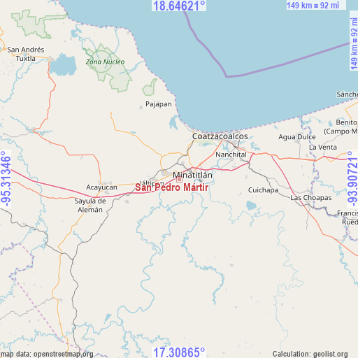
San Pedro Mártir GPS coordinates[2]
17° 58' 43.32" North, 94° 36' 37.188" West
| Map corner | latitude | longitude |
|---|---|---|
| Upper-left | 18.64621°, | -95.31346° |
| Center: | 17.9787°, | -94.61033° |
| Lower-right: | 17.30865°, | -93.90721° |
| Map W x H: | 148.7×148.7 km | = 92.4×92.4mi |
| max Lat: | 32.7° ⇑78.9% North |
| San Pedro Mártir: | 17.9787° |
| min Lat: | ⇓21.1% South 14.53588° |
| min Long | San Pedro Márt | max Long |
| -117.105° | -94.61033° | -86.73105° |
| W 85.3%⇐ | ⇒14.7% E |
Elevation
Elevation of San Pedro Mártir is 35 m = 115 ft, and this is 1218.7 m = 3998 ft below average elevation for this country.
| Max E: |
3497 m = 11473 ft | 86.7% |
| Avg. | 1253.7 m = 4113 ft | |
| San Pedro Mártir | 35 m = 115 ft | |
Min E: |
-1 m = -3 ft | 13.3% |
See also: Mexico elevation on elevation.city.
Geographical zone
San Pedro Mártir is located in North Torrid zone (between Equator and Tropic of Cancer). Distance of this Northern Tropic circle is 606.9 km =377.1 mi to North.| Distance of | km | miles | from San Pedro Mártir |
|---|---|---|---|
| North Pole | 8008 | 4975.9 | to North |
| Arctic Circle | 5402.1 | 3356.7 | to North |
| Tropic Cancer | 606.9 | 377.1 | to North |
| Equator | 1999 | 1242.1 | to South |


Nearby cities:
15 places around San Pedro Mártir: (largest is in red/bold)
• Coacotla
7.6 km =4.7 mi,  232°
232°
• Colonia Luis Donaldo Colosio
1.6 km =1 mi,  358°
358°
• Cosoleacaque
3.5 km =2.2 mi,  310°
310°
• El Jagüey
4.9 km =3 mi,  106°
106°
• El Naranjito
2.2 km =1.4 mi,  10°
10°
• Fraccionamiento los Prados
3.1 km =1.9 mi,  268°
268°
• Hermenegildo J. Aldana
3.1 km =1.9 mi, 356°
• José F. Gutiérrez
5.2 km =3.2 mi,  0°
0°
• La Esperanza
5.2 km =3.2 mi, 6°
• Las Jacarandas
2.7 km =1.7 mi, 0°
• Las Lomas
6 km =3.7 mi,  120°
120°
• Mapachapa
7.3 km =4.5 mi,  38°
38°
• Minatitlán
6.1 km =3.8 mi,  67°
67°
• Oteapan
6.4 km =4 mi,  293°
293°
• Zaragoza
4.1 km =2.5 mi,  235°
235°
Sources, notices
• [Note1] Compared only with cities in Mexico existing in our database
• [Src1] Map data: © OpenStreetMap contributors (CC-BY-SA)
• [Src2] Other city data from geonames.org with taken over terms of usage.
• [Src3] Geographical zone / Annual Mean Temperature by Robert A. Rohde @ Wikipedia
