San Miguel Tenextatiloyan geodata
San Miguel Tenextatiloyan (Puebla) is a populated place; located in Mexico in America/Mexico_City (GMT-6) time zone. With population of 4,209 people, there are 2181 cities with bigger population in this country. Compared to other cities in Mexico, 50.7% of cities are located further ↓South; 68.4% of cities are located further ←West and 90.6% of cities have lower elevation than San Miguel Tenextatiloyan. Note1
Current local time in San Miguel Tenextatiloyan:
12:29 PM, MondayDifference from your time zone: hours


San Miguel Tenextatiloyan GPS coordinates[2]
19° 42' 35.028" North, 97° 35' 51.684" West
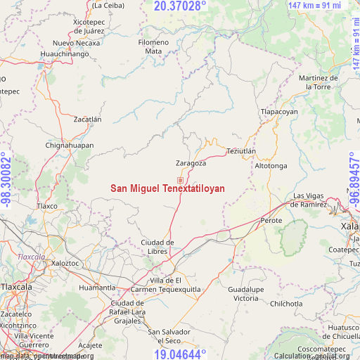
| Map corner | latitude | longitude |
|---|---|---|
| Upper-left | 20.37028°, | -98.30082° |
| Center: | 19.70973°, | -97.59769° |
| Lower-right: | 19.04644°, | -96.89457° |
| Map W x H: | 147.2×147.2 km | = 91.5×91.5mi |
| max Lat: | 32.7° ⇑49.3% North |
| San Miguel Tenextatiloyan: | 19.70973° |
| min Lat: | ⇓50.7% South 14.53588° |
| min Long | San Miguel Tene | max Long |
| -117.105° | -97.59769° | -86.73105° |
| W 68.4%⇐ | ⇒31.6% E |
Elevation
Elevation of San Miguel Tenextatiloyan is 2429 m = 7969 ft, and this is 1175.3 m = 3856 ft above average elevation for this country.
| Max E: |
3497 m = 11473 ft | 9.4% |
| San Miguel Tenextatiloyan | 2429 m 7969 ft | |
| Avg. | 1253.7 m = 4113 ft | |
Min E: |
-1 m = -3 ft | 90.6% |
See also: Mexico elevation on elevation.city.
Geographical zone
San Miguel Tenextatiloyan is located in North Torrid zone (between Equator and Tropic of Cancer). Distance of this Northern Tropic circle is 414.4 km =257.5 mi to North.| Distance of | km | miles | from San Miguel Tenextatiloyan |
|---|---|---|---|
| North Pole | 7815.5 | 4856.3 | to North |
| Arctic Circle | 5209.7 | 3237.2 | to North |
| Tropic Cancer | 414.4 | 257.5 | to North |
| Equator | 2191.5 | 1361.7 | to South |


Nearby cities:
15 places around San Miguel Tenextatiloyan: (largest is in red/bold)
• Acuaco
6.8 km =4.2 mi,  30°
30°
• Chilapa
8.6 km =5.3 mi,  316°
316°
• Cuautlamingo
8.7 km =5.4 mi,  46°
46°
• Emilio Carranza (Santa Cruz)
5.8 km =3.6 mi,  273°
273°
• Huitzitzilapan
1.9 km =1.2 mi,  111°
111°
• Ixmatlaco
5.2 km =3.2 mi,  82°
82°
• La Libertad
5.2 km =3.2 mi,  348°
348°
• Las Trancas
3.3 km =2.1 mi, 45°
• Morelos
5.4 km =3.4 mi,  22°
22°
• Oyameles de Hidalgo
6.8 km =4.2 mi,  101°
101°
• San Francisco del Progreso
2.5 km =1.6 mi,  333°
333°
• San José Buenavista
7.9 km =4.9 mi, 25°
• Texocoyohuac
7.6 km =4.7 mi,  5°
5°
• Zaragoza
8.1 km =5 mi, 33°
• Zautla
7.7 km =4.8 mi, 274°
Sources, notices
• [Note1] Compared only with cities in Mexico existing in our database
• [Src1] Map data: © OpenStreetMap contributors (CC-BY-SA)
• [Src2] Other city data from geonames.org with taken over terms of usage.
• [Src3] Geographical zone / Annual Mean Temperature by Robert A. Rohde @ Wikipedia
