San Miguel Amatitlán geodata
San Miguel Amatitlán (Oaxaca) is a populated place; located in Mexico in America/Mexico_City (GMT-6) time zone. With population of 661 people, there are 13143 cities with bigger population in this country. Compared to other cities in Mexico, 79.8% of cities are located further ↑North; 63.3% of cities are located further ←West and 54.6% of cities have lower elevation than San Miguel Amatitlán. Note1
Current local time in San Miguel Amatitlán:
06:45 AM, WednesdayDifference from your time zone: hours


San Miguel Amatitlán GPS coordinates[2]
17° 53' 30.336" North, 98° 1' 28.56" West
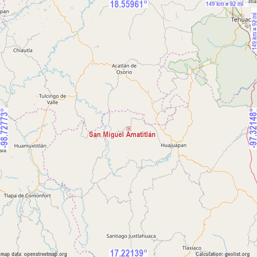
| Map corner | latitude | longitude |
|---|---|---|
| Upper-left | 18.55961°, | -98.72773° |
| Center: | 17.89176°, | -98.0246° |
| Lower-right: | 17.22139°, | -97.32148° |
| Map W x H: | 148.8×148.8 km | = 92.5×92.5mi |
| max Lat: | 32.7° ⇑79.8% North |
| San Miguel Amatitlán: | 17.89176° |
| min Lat: | ⇓20.2% South 14.53588° |
| min Long | San Miguel Amat | max Long |
| -117.105° | -98.0246° | -86.73105° |
| W 63.3%⇐ | ⇒36.7% E |
Elevation
Elevation of San Miguel Amatitlán is 1578 m = 5177 ft, and this is 324.3 m = 1064 ft above average elevation for this country.
| Max E: |
3497 m = 11473 ft | 45.4% |
| San Miguel Amatitlán | 1578 m 5177 ft | |
| Avg. | 1253.7 m = 4113 ft | |
Min E: |
-1 m = -3 ft | 54.6% |
See also: Mexico elevation on elevation.city.
Geographical zone
San Miguel Amatitlán is located in North Torrid zone (between Equator and Tropic of Cancer). Distance of this Northern Tropic circle is 616.5 km =383.1 mi to North.| Distance of | km | miles | from San Miguel Amatitlán |
|---|---|---|---|
| North Pole | 8017.7 | 4982 | to North |
| Arctic Circle | 5411.8 | 3362.7 | to North |
| Tropic Cancer | 616.5 | 383.1 | to North |
| Equator | 1989.4 | 1236.2 | to South |


Nearby cities:
15 places around San Miguel Amatitlán: (largest is in red/bold)
• 5 de Mayo
7.2 km =4.5 mi,  160°
160°
• Francisco Ibarra Ramos
14.8 km =9.2 mi,  49°
49°
• Mariscala de Juárez
12.8 km =8 mi,  253°
253°
• Nicolás Hidalgo
17.5 km =10.9 mi,  226°
226°
• San Andrés Sabinillo
16.7 km =10.4 mi,  182°
182°
• San Jorge el Zapote
3.7 km =2.3 mi, 50°
• San José Ayuquila
8.2 km =5.1 mi, 46°
• San Lorenzo Vista Hermosa
8.8 km =5.5 mi,  328°
328°
• San Martín Zacatepec
10.1 km =6.3 mi,  202°
202°
• Santa Catarina Estancia
7.3 km =4.5 mi,  10°
10°
• Santa Cruz Tacache de Mina
15.3 km =9.5 mi,  242°
242°
• Santiago Ayuquililla
8.4 km =5.2 mi,  57°
57°
• Santiago Chilixtlahuaca
13.8 km =8.6 mi,  83°
83°
• Santo Domingo Yolotepec
11.5 km =7.1 mi,  140°
140°
• Santos Reyes Yucuna
13 km =8.1 mi,  168°
168°
Sources, notices
• [Note1] Compared only with cities in Mexico existing in our database
• [Src1] Map data: © OpenStreetMap contributors (CC-BY-SA)
• [Src2] Other city data from geonames.org with taken over terms of usage.
• [Src3] Geographical zone / Annual Mean Temperature by Robert A. Rohde @ Wikipedia
