San Lorenzo Vista Hermosa geodata
San Lorenzo Vista Hermosa (Oaxaca) is a populated place; located in Mexico in America/Mexico_City (GMT-6) time zone. With population of 1,367 people, there are 6353 cities with bigger population in this country. Compared to other cities in Mexico, 79.1% of cities are located further ↑North; 62.8% of cities are located further ←West and 52.8% of cities have lower elevation than San Lorenzo Vista Hermosa. Note1
Current local time in San Lorenzo Vista Hermosa:
08:34 AM, WednesdayDifference from your time zone: hours


San Lorenzo Vista Hermosa GPS coordinates[2]
17° 57' 31.968" North, 98° 4' 6.672" West
| Map corner | latitude | longitude |
|---|---|---|
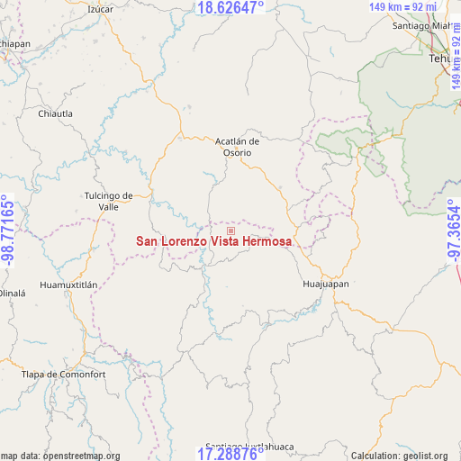
| Upper-left | 18.62647°, | -98.77165° |
| Center: | 17.95888°, | -98.06852° |
| Lower-right: | 17.28876°, | -97.3654° |
| Map W x H: | 148.7×148.7 km | = 92.4×92.4mi |
| max Lat: | 32.7° ⇑79.1% North |
| San Lorenzo Vista Hermosa: | 17.95888° |
| min Lat: | ⇓20.9% South 14.53588° |
| min Long | San Lorenzo Vis | max Long |
| -117.105° | -98.06852° | -86.73105° |
| W 62.8%⇐ | ⇒37.2% E |
Elevation
Elevation of San Lorenzo Vista Hermosa is 1538 m = 5046 ft, and this is 284.3 m = 933 ft above average elevation for this country.
| Max E: |
3497 m = 11473 ft | 47.2% |
| San Lorenzo Vista Hermosa | 1538 m 5046 ft | |
| Avg. | 1253.7 m = 4113 ft | |
Min E: |
-1 m = -3 ft | 52.8% |
See also: Mexico elevation on elevation.city.
Geographical zone
San Lorenzo Vista Hermosa is located in North Torrid zone (between Equator and Tropic of Cancer). Distance of this Northern Tropic circle is 609.1 km =378.5 mi to North.| Distance of | km | miles | from San Lorenzo Vista Hermosa |
|---|---|---|---|
| North Pole | 8010.2 | 4977.3 | to North |
| Arctic Circle | 5404.3 | 3358.1 | to North |
| Tropic Cancer | 609.1 | 378.5 | to North |
| Equator | 1996.8 | 1240.8 | to South |


Nearby cities:
15 places around San Lorenzo Vista Hermosa: (largest is in red/bold)
• 5 de Mayo
15.9 km =9.9 mi,  153°
153°
• Francisco Ibarra Ramos
16.1 km =10 mi,  82°
82°
• Guadalupe Santa Ana
15.7 km =9.8 mi,  339°
339°
• Mariscala de Juárez
13.4 km =8.3 mi,  214°
214°
• Mixquitepec
15.5 km =9.6 mi,  329°
329°
• San Antonio Chiltepec
12.7 km =7.9 mi,  294°
294°
• San Isidro Labrador
16.3 km =10.1 mi,  359°
359°
• San Jorge el Zapote
9.1 km =5.7 mi,  124°
124°
• San José Ayuquila
10.7 km =6.6 mi,  99°
99°
• San Juan Llano Grande
12.1 km =7.5 mi,  350°
350°
• San Miguel Amatitlán
8.8 km =5.5 mi, 148°
• Santa Catarina Estancia
6 km =3.7 mi,  92°
92°
• Santiago Ayuquililla
12.1 km =7.5 mi, 103°
• Texcalapa de Juárez
14.5 km =9 mi,  35°
35°
• Vista Hermosa
14.7 km =9.1 mi, 332°
Sources, notices
• [Note1] Compared only with cities in Mexico existing in our database
• [Src1] Map data: © OpenStreetMap contributors (CC-BY-SA)
• [Src2] Other city data from geonames.org with taken over terms of usage.
• [Src3] Geographical zone / Annual Mean Temperature by Robert A. Rohde @ Wikipedia
