Santo Domingo Yolotepec geodata
Santo Domingo Yolotepec (Oaxaca) is a populated place; located in Mexico in America/Mexico_City (GMT-6) time zone. With population of 755 people, there are 11595 cities with bigger population in this country. Compared to other cities in Mexico, 80.4% of cities are located further ↑North; 64.2% of cities are located further ←West and 75.2% of cities have lower elevation than Santo Domingo Yolotepec. Note1
Current local time in Santo Domingo Yolotepec:
08:35 AM, WednesdayDifference from your time zone: hours


Santo Domingo Yolotepec GPS coordinates[2]
17° 48' 44.352" North, 97° 57' 17.388" West
| Map corner | latitude | longitude |
|---|---|---|
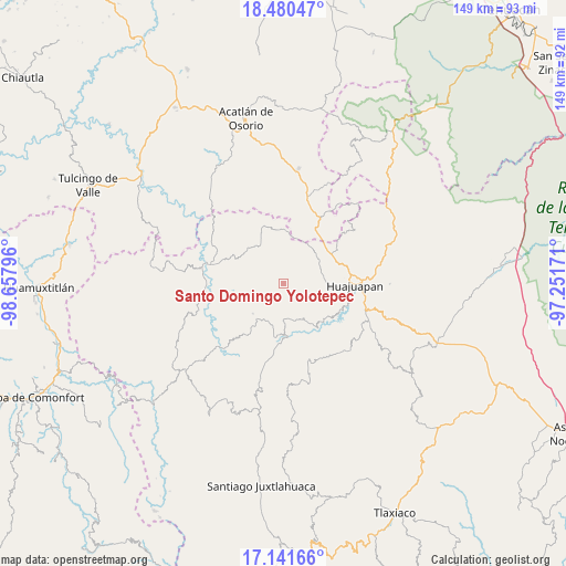
| Upper-left | 18.48047°, | -98.65796° |
| Center: | 17.81232°, | -97.95483° |
| Lower-right: | 17.14166°, | -97.25171° |
| Map W x H: | 148.9×148.9 km | = 92.5×92.5mi |
| max Lat: | 32.7° ⇑80.4% North |
| Santo Domingo Yolotepec: | 17.81232° |
| min Lat: | ⇓19.6% South 14.53588° |
| min Long | Santo Domingo Y | max Long |
| -117.105° | -97.95483° | -86.73105° |
| W 64.2%⇐ | ⇒35.8% E |
Elevation
Elevation of Santo Domingo Yolotepec is 2034 m = 6673 ft, and this is 780.3 m = 2560 ft above average elevation for this country.
| Max E: |
3497 m = 11473 ft | 24.8% |
| Santo Domingo Yolotepec | 2034 m 6673 ft | |
| Avg. | 1253.7 m = 4113 ft | |
Min E: |
-1 m = -3 ft | 75.2% |
See also: Mexico elevation on elevation.city.
Geographical zone
Santo Domingo Yolotepec is located in North Torrid zone (between Equator and Tropic of Cancer). Distance of this Northern Tropic circle is 625.4 km =388.6 mi to North.| Distance of | km | miles | from Santo Domingo Yolotepec |
|---|---|---|---|
| North Pole | 8026.5 | 4987.4 | to North |
| Arctic Circle | 5420.6 | 3368.2 | to North |
| Tropic Cancer | 625.4 | 388.6 | to North |
| Equator | 1980.5 | 1230.6 | to South |


Nearby cities:
15 places around Santo Domingo Yolotepec: (largest is in red/bold)
• 5 de Mayo
5.4 km =3.4 mi,  292°
292°
• Acatilma
15.4 km =9.6 mi,  83°
83°
• Colonia Buena Vista
14.8 km =9.2 mi, 84°
• San Andrés Sabinillo
11.3 km =7 mi,  225°
225°
• San Jerónimo Silacayoapilla
11.6 km =7.2 mi,  91°
91°
• San Jorge el Zapote
12.1 km =7.5 mi,  338°
338°
• San José Ayuquila
14.5 km =9 mi,  354°
354°
• San Marcos Arteaga
14.1 km =8.8 mi,  134°
134°
• San Martín Zacatepec
11.2 km =7 mi,  267°
267°
• San Miguel Amatitlán
11.5 km =7.1 mi,  320°
320°
• Santiago Ayuquililla
13.4 km =8.3 mi,  358°
358°
• Santiago Chilixtlahuaca
12.2 km =7.6 mi,  31°
31°
• Santo Domingo Tonalá
15.5 km =9.6 mi,  184°
184°
• Santos Reyes Yucuna
6.3 km =3.9 mi, 231°
• Saucitlán de Morelos
13.1 km =8.1 mi,  105°
105°
Sources, notices
• [Note1] Compared only with cities in Mexico existing in our database
• [Src1] Map data: © OpenStreetMap contributors (CC-BY-SA)
• [Src2] Other city data from geonames.org with taken over terms of usage.
• [Src3] Geographical zone / Annual Mean Temperature by Robert A. Rohde @ Wikipedia
