San Miguel Achiutla geodata
San Miguel Achiutla (Oaxaca) is a seat of a second-order administrative division; located in Mexico in America/Mexico_City (GMT-6) time zone. With population of 342 people, there are 16862 cities with bigger population in this country. Compared to other cities in Mexico, 85.2% of cities are located further ↑North; 69.7% of cities are located further ←West and 73.6% of cities have lower elevation than San Miguel Achiutla. Note1


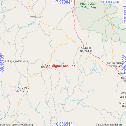
San Miguel Achiutla GPS coordinates[2]
17° 18' 32.4" North, 97° 29' 2.112" West
| Map corner | latitude | longitude |
|---|---|---|
| Upper-left | 17.97904°, | -98.18705° |
| Center: | 17.309°, | -97.48392° |
| Lower-right: | 16.63651°, | -96.7808° |
| Map W x H: | 149.3×149.3 km | = 92.8×92.8mi |
| max Lat: | 32.7° ⇑85.2% North |
| San Miguel Achiutla: | 17.309° |
| min Lat: | ⇓14.8% South 14.53588° |
| min Long | San Miguel Achi | max Long |
| -117.105° | -97.48392° | -86.73105° |
| W 69.7%⇐ | ⇒30.3% E |
Elevation
Elevation of San Miguel Achiutla is 2003 m = 6572 ft, and this is 749.3 m = 2458 ft above average elevation for this country.
| Max E: |
3497 m = 11473 ft | 26.4% |
| San Miguel Achiutla | 2003 m 6572 ft | |
| Avg. | 1253.7 m = 4113 ft | |
Min E: |
-1 m = -3 ft | 73.6% |
See also: Mexico elevation on elevation.city.
Geographical zone
San Miguel Achiutla is located in North Torrid zone (between Equator and Tropic of Cancer). Distance of this Northern Tropic circle is 681.3 km =423.3 mi to North.| Distance of | km | miles | from San Miguel Achiutla |
|---|---|---|---|
| North Pole | 8082.5 | 5022.2 | to North |
| Arctic Circle | 5476.6 | 3403 | to North |
| Tropic Cancer | 681.3 | 423.3 | to North |
| Equator | 1924.6 | 1195.9 | to South |


Nearby cities:
15 places around San Miguel Achiutla: (largest is in red/bold)
• Magdalena Yodocono de Porfirio Díaz
16 km =9.9 mi,  58°
58°
• San Cristóbal Amoltepec
9.8 km =6.1 mi,  253°
253°
• San Francisco Nuxaño
17 km =10.6 mi, 61°
• San Isidro
13.8 km =8.6 mi,  222°
222°
• San Juan Achiutla
5.2 km =3.2 mi,  330°
330°
• San Juan Diuxi
12.4 km =7.7 mi,  101°
101°
• San Pedro Tidaá
12.4 km =7.7 mi,  73°
73°
• San Pedro el Alto
17.9 km =11.1 mi,  172°
172°
• San Vicente Nuñu
17 km =10.6 mi,  14°
14°
• Santa Catarina Tayata
9 km =5.6 mi,  298°
298°
• Santa Cruz Tayata
10.4 km =6.5 mi, 300°
• Santa María Nduayaco
11.3 km =7 mi,  354°
354°
• Santa María del Rosario
12.7 km =7.9 mi,  292°
292°
• Santiago Nejapilla
17 km =10.6 mi,  43°
43°
• Santiago Tilantongo
15.6 km =9.7 mi, 99°
Sources, notices
• [Note1] Compared only with cities in Mexico existing in our database
• [Src1] Map data: © OpenStreetMap contributors (CC-BY-SA)
• [Src2] Other city data from geonames.org with taken over terms of usage.
• [Src3] Geographical zone / Annual Mean Temperature by Robert A. Rohde @ Wikipedia
