Santiago Nejapilla geodata
Santiago Nejapilla (Oaxaca) is a seat of a second-order administrative division; located in Mexico in America/Mexico_City (GMT-6) time zone. With population of 192 people, there are 16887 cities with bigger population in this country. Compared to other cities in Mexico, 84% of cities are located further ↑North; 70.8% of cities are located further ←West and 84.7% of cities have lower elevation than Santiago Nejapilla. Note1


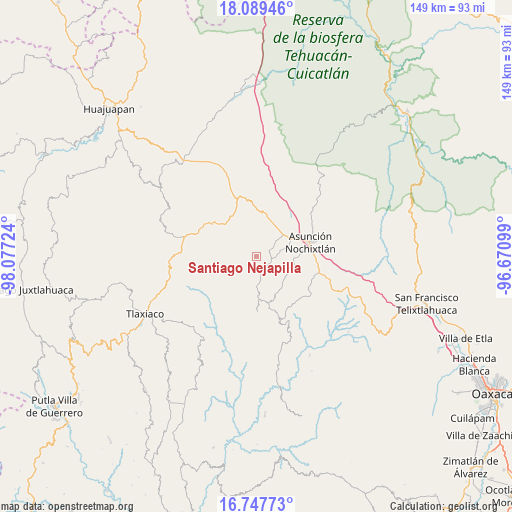
Santiago Nejapilla GPS coordinates[2]
17° 25' 11.388" North, 97° 22' 26.796" West
| Map corner | latitude | longitude |
|---|---|---|
| Upper-left | 18.08946°, | -98.07724° |
| Center: | 17.41983°, | -97.37411° |
| Lower-right: | 16.74773°, | -96.67099° |
| Map W x H: | 149.2×149.2 km | = 92.7×92.7mi |
| max Lat: | 32.7° ⇑84% North |
| Santiago Nejapilla: | 17.41983° |
| min Lat: | ⇓16% South 14.53588° |
| min Long | Santiago Nejapi | max Long |
| -117.105° | -97.37411° | -86.73105° |
| W 70.8%⇐ | ⇒29.2% E |
Elevation
Elevation of Santiago Nejapilla is 2255 m = 7398 ft, and this is 1001.3 m = 3285 ft above average elevation for this country.
| Max E: |
3497 m = 11473 ft | 15.3% |
| Santiago Nejapilla | 2255 m 7398 ft | |
| Avg. | 1253.7 m = 4113 ft | |
Min E: |
-1 m = -3 ft | 84.7% |
See also: Mexico elevation on elevation.city.
Geographical zone
Santiago Nejapilla is located in North Torrid zone (between Equator and Tropic of Cancer). Distance of this Northern Tropic circle is 669 km =415.7 mi to North.| Distance of | km | miles | from Santiago Nejapilla |
|---|---|---|---|
| North Pole | 8070.2 | 5014.6 | to North |
| Arctic Circle | 5464.3 | 3395.4 | to North |
| Tropic Cancer | 669 | 415.7 | to North |
| Equator | 1936.9 | 1203.5 | to South |


Nearby cities:
15 places around Santiago Nejapilla: (largest is in red/bold)
• Magdalena Yodocono de Porfirio Díaz
4.4 km =2.7 mi,  152°
152°
• San Andrés Sinaxtla
11.1 km =6.9 mi,  60°
60°
• San Francisco Chindúa
6.6 km =4.1 mi,  81°
81°
• San Francisco Jaltepetongo
12.2 km =7.6 mi,  108°
108°
• San Francisco Nuxaño
5.4 km =3.4 mi,  141°
141°
• San Juan Sayultepec
10.2 km =6.3 mi,  68°
68°
• San Mateo Etlatongo
10.6 km =6.6 mi,  92°
92°
• San Miguel Tecomatlán
11.6 km =7.2 mi,  104°
104°
• San Pedro Tidaá
8.7 km =5.4 mi,  178°
178°
• San Pedro Topiltepec
3.7 km =2.3 mi, 60°
• San Vicente Nuñu
8.4 km =5.2 mi,  299°
299°
• Santa María Nduayaco
12.7 km =7.9 mi,  265°
265°
• Santiago Tillo
7.3 km =4.5 mi,  51°
51°
• Santo Domingo Tlatayapam
3.3 km =2.1 mi, 114°
• Santo Domingo Yanhuitlán
12.5 km =7.8 mi,  15°
15°
Sources, notices
• [Note1] Compared only with cities in Mexico existing in our database
• [Src1] Map data: © OpenStreetMap contributors (CC-BY-SA)
• [Src2] Other city data from geonames.org with taken over terms of usage.
• [Src3] Geographical zone / Annual Mean Temperature by Robert A. Rohde @ Wikipedia
