San Vicente Nuñu geodata
San Vicente Nuñu (Oaxaca) is a seat of a second-order administrative division; located in Mexico in America/Mexico_City (GMT-6) time zone. With population of 334 people, there are 16865 cities with bigger population in this country. Compared to other cities in Mexico, 83.5% of cities are located further ↑North; 70.1% of cities are located further ←West and 89.1% of cities have lower elevation than San Vicente Nuñu. Note1


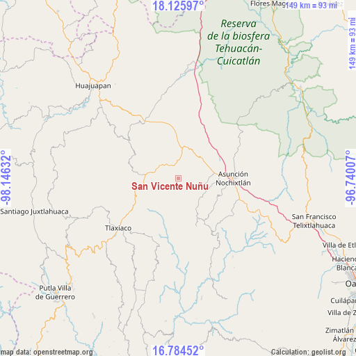
San Vicente Nuñu GPS coordinates[2]
17° 27' 23.328" North, 97° 26' 35.484" West
| Map corner | latitude | longitude |
|---|---|---|
| Upper-left | 18.12597°, | -98.14632° |
| Center: | 17.45648°, | -97.44319° |
| Lower-right: | 16.78452°, | -96.74007° |
| Map W x H: | 149.2×149.2 km | = 92.7×92.7mi |
| max Lat: | 32.7° ⇑83.5% North |
| San Vicente Nuñu: | 17.45648° |
| min Lat: | ⇓16.5% South 14.53588° |
| min Long | San Vicente Nu� | max Long |
| -117.105° | -97.44319° | -86.73105° |
| W 70.1%⇐ | ⇒29.9% E |
Elevation
Elevation of San Vicente Nuñu is 2377 m = 7799 ft, and this is 1123.3 m = 3685 ft above average elevation for this country.
| Max E: |
3497 m = 11473 ft | 10.9% |
| San Vicente Nuñu | 2377 m 7799 ft | |
| Avg. | 1253.7 m = 4113 ft | |
Min E: |
-1 m = -3 ft | 89.1% |
See also: Mexico elevation on elevation.city.
Geographical zone
San Vicente Nuñu is located in North Torrid zone (between Equator and Tropic of Cancer). Distance of this Northern Tropic circle is 664.9 km =413.1 mi to North.| Distance of | km | miles | from San Vicente Nuñu |
|---|---|---|---|
| North Pole | 8066.1 | 5012 | to North |
| Arctic Circle | 5460.2 | 3392.8 | to North |
| Tropic Cancer | 664.9 | 413.1 | to North |
| Equator | 1941 | 1206.1 | to South |


Nearby cities:
15 places around San Vicente Nuñu: (largest is in red/bold)
• Magdalena Yodocono de Porfirio Díaz
12.3 km =7.6 mi,  130°
130°
• San Francisco Chindúa
14.2 km =8.8 mi,  102°
102°
• San Francisco Nuxaño
13.5 km =8.4 mi, 127°
• San Juan Achiutla
13.7 km =8.5 mi,  210°
210°
• San Juan Sayultepec
16.8 km =10.4 mi,  91°
91°
• San Miguel Achiutla
17 km =10.6 mi,  194°
194°
• San Pedro Tidaá
14.9 km =9.3 mi,  149°
149°
• San Pedro Topiltepec
10.8 km =6.7 mi, 102°
• San Pedro y San Pablo Teposcolula
7.7 km =4.8 mi,  322°
322°
• Santa María Nduayaco
7.4 km =4.6 mi,  225°
225°
• Santiago Nejapilla
8.4 km =5.2 mi,  119°
119°
• Santiago Tillo
13.1 km =8.1 mi, 87°
• Santiago Yolomécatl
13.5 km =8.4 mi,  277°
277°
• Santo Domingo Tlatayapam
11.7 km =7.3 mi, 117°
• Santo Domingo Yanhuitlán
13.3 km =8.3 mi,  53°
53°
Sources, notices
• [Note1] Compared only with cities in Mexico existing in our database
• [Src1] Map data: © OpenStreetMap contributors (CC-BY-SA)
• [Src2] Other city data from geonames.org with taken over terms of usage.
• [Src3] Geographical zone / Annual Mean Temperature by Robert A. Rohde @ Wikipedia
