Tlaixpan geodata
Tlaixpan (Puebla) is a populated place; located in Mexico in America/Mexico_City (GMT-6) time zone. With population of 10,513 people, there are 904 cities with bigger population in this country. Compared to other cities in Mexico, 66.7% of cities are located further ↑North; 66.8% of cities are located further ←West and 76.5% of cities have lower elevation than Tlaixpan. Note1


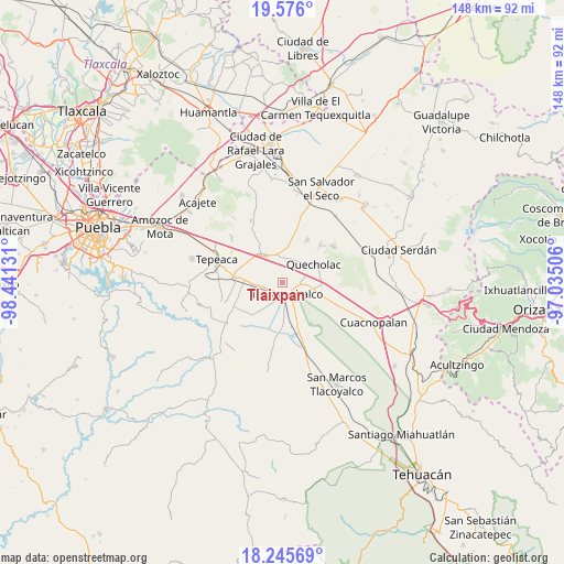
Tlaixpan GPS coordinates[2]
18° 54' 43.812" North, 97° 44' 17.448" West
| Map corner | latitude | longitude |
|---|---|---|
| Upper-left | 19.576°, | -98.44131° |
| Center: | 18.91217°, | -97.73818° |
| Lower-right: | 18.24569°, | -97.03506° |
| Map W x H: | 147.9×147.9 km | = 91.9×91.9mi |
| max Lat: | 32.7° ⇑66.7% North |
| Tlaixpan: | 18.91217° |
| min Lat: | ⇓33.3% South 14.53588° |
| min Long | Tlaixpan | max Long |
| -117.105° | -97.73818° | -86.73105° |
| W 66.8%⇐ | ⇒33.2% E |
Elevation
Elevation of Tlaixpan is 2058 m = 6752 ft, and this is 804.3 m = 2639 ft above average elevation for this country.
| Max E: |
3497 m = 11473 ft | 23.5% |
| Tlaixpan | 2058 m 6752 ft | |
| Avg. | 1253.7 m = 4113 ft | |
Min E: |
-1 m = -3 ft | 76.5% |
See also: Mexico elevation on elevation.city.
Geographical zone
Tlaixpan is located in North Torrid zone (between Equator and Tropic of Cancer). Distance of this Northern Tropic circle is 503.1 km =312.6 mi to North.| Distance of | km | miles | from Tlaixpan |
|---|---|---|---|
| North Pole | 7904.2 | 4911.4 | to North |
| Arctic Circle | 5298.3 | 3292.2 | to North |
| Tropic Cancer | 503.1 | 312.6 | to North |
| Equator | 2102.8 | 1306.6 | to South |


Nearby cities:
15 places around Tlaixpan: (largest is in red/bold)
• Francisco I. Madero
6.1 km =3.8 mi,  71°
71°
• Francisco Villa
8 km =5 mi,  199°
199°
• Huixcolotla
3.6 km =2.2 mi,  285°
285°
• José María Pino Suárez
5.6 km =3.5 mi,  176°
176°
• La Compañia
6.7 km =4.2 mi,  13°
13°
• Lomas de Romero
2.2 km =1.4 mi,  83°
83°
• Lomas de Santa Cruz
1.6 km =1 mi,  32°
32°
• Los Reyes de Juárez
8 km =5 mi,  300°
300°
• Progreso de Juárez
5.8 km =3.6 mi,  341°
341°
• San Antonio Tecolco
7.9 km =4.9 mi,  212°
212°
• San Simón
6.7 km =4.2 mi,  24°
24°
• Santa Rosa
6 km =3.7 mi,  229°
229°
• Tecamachalco
3.2 km =2 mi,  171°
171°
• Tuzuapan
7.6 km =4.7 mi,  99°
99°
• Xochimilco
7.9 km =4.9 mi, 170°
Sources, notices
• [Note1] Compared only with cities in Mexico existing in our database
• [Src1] Map data: © OpenStreetMap contributors (CC-BY-SA)
• [Src2] Other city data from geonames.org with taken over terms of usage.
• [Src3] Geographical zone / Annual Mean Temperature by Robert A. Rohde @ Wikipedia
