San Simón geodata
San Simón (Puebla) is a populated place; located in Mexico in America/Mexico_City (GMT-6) time zone. With population of 4,980 people, there are 1856 cities with bigger population in this country. Compared to other cities in Mexico, 65.4% of cities are located further ↑North; 67.1% of cities are located further ←West and 79.5% of cities have lower elevation than San Simón. Note1


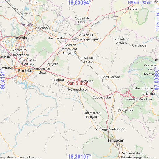
San Simón GPS coordinates[2]
18° 58' 2.388" North, 97° 42' 43.092" West
| Map corner | latitude | longitude |
|---|---|---|
| Upper-left | 19.63094°, | -98.4151° |
| Center: | 18.96733°, | -97.71197° |
| Lower-right: | 18.30107°, | -97.00885° |
| Map W x H: | 147.9×147.9 km | = 91.9×91.9mi |
| max Lat: | 32.7° ⇑65.4% North |
| San Simón: | 18.96733° |
| min Lat: | ⇓34.6% South 14.53588° |
| min Long | San Simón | max Long |
| -117.105° | -97.71197° | -86.73105° |
| W 67.1%⇐ | ⇒32.9% E |
Elevation
Elevation of San Simón is 2128 m = 6982 ft, and this is 874.3 m = 2868 ft above average elevation for this country.
| Max E: |
3497 m = 11473 ft | 20.5% |
| San Simón | 2128 m 6982 ft | |
| Avg. | 1253.7 m = 4113 ft | |
Min E: |
-1 m = -3 ft | 79.5% |
See also: Mexico elevation on elevation.city.
Geographical zone
San Simón is located in North Torrid zone (between Equator and Tropic of Cancer). Distance of this Northern Tropic circle is 496.9 km =308.8 mi to North.| Distance of | km | miles | from San Simón |
|---|---|---|---|
| North Pole | 7898.1 | 4907.7 | to North |
| Arctic Circle | 5292.2 | 3288.4 | to North |
| Tropic Cancer | 496.9 | 308.8 | to North |
| Equator | 2109 | 1310.5 | to South |


Nearby cities:
15 places around San Simón: (largest is in red/bold)
• Acatzingo
7.7 km =4.8 mi,  282°
282°
• Actipan de Morelos
9.2 km =5.7 mi,  264°
264°
• Candelaria Portezuelo
8.4 km =5.2 mi,  8°
8°
• Francisco I. Madero
5.1 km =3.2 mi,  144°
144°
• Huixcolotla
8.1 km =5 mi,  230°
230°
• La Compañia
1.2 km =0.7 mi,  288°
288°
• Lomas de Romero
5.9 km =3.7 mi,  185°
185°
• Lomas de Santa Cruz
5.1 km =3.2 mi,  201°
201°
• Progreso de Juárez
4.6 km =2.9 mi, 262°
• Quecholac
5.8 km =3.6 mi,  104°
104°
• San Antonio Portezuelo
3.5 km =2.2 mi,  357°
357°
• San Pablo de las Tunas
3.1 km =1.9 mi,  4°
4°
• Santiago Tenango
8.2 km =5.1 mi,  60°
60°
• Tlaixpan
6.7 km =4.2 mi, 204°
• Tuzuapan
8.8 km =5.5 mi,  147°
147°
Sources, notices
• [Note1] Compared only with cities in Mexico existing in our database
• [Src1] Map data: © OpenStreetMap contributors (CC-BY-SA)
• [Src2] Other city data from geonames.org with taken over terms of usage.
• [Src3] Geographical zone / Annual Mean Temperature by Robert A. Rohde @ Wikipedia
