San Mateo Ixtlahuaca geodata
San Mateo Ixtlahuaca (State of Mexico) is a populated place; located in Mexico in America/Mexico_City (GMT-6) time zone. With population of 2,304 people, there are 3826 cities with bigger population in this country. Compared to other cities in Mexico, 51.7% of cities are located further ↑North; 61.5% of cities are located further →East and 93.1% of cities have lower elevation than San Mateo Ixtlahuaca. Note1
Current local time in San Mateo Ixtlahuaca:
06:47 AM, WednesdayDifference from your time zone: hours


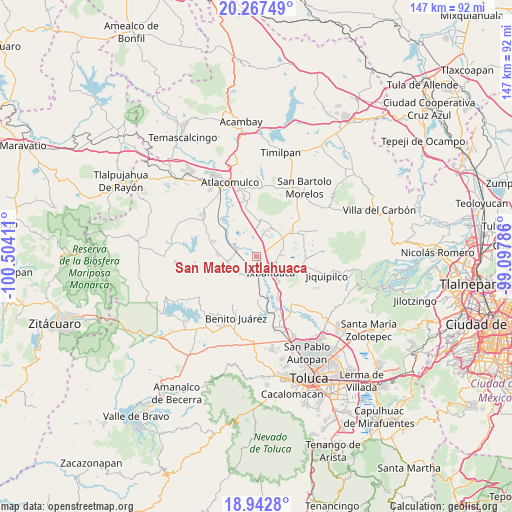
San Mateo Ixtlahuaca GPS coordinates[2]
19° 36' 23.436" North, 99° 48' 3.528" West
| Map corner | latitude | longitude |
|---|---|---|
| Upper-left | 20.26749°, | -100.50411° |
| Center: | 19.60651°, | -99.80098° |
| Lower-right: | 18.9428°, | -99.09786° |
| Map W x H: | 147.3×147.3 km | = 91.5×91.5mi |
| max Lat: | 32.7° ⇑51.7% North |
| San Mateo Ixtlahuaca: | 19.60651° |
| min Lat: | ⇓48.3% South 14.53588° |
| min Long | San Mateo Ixtla | max Long |
| -117.105° | -99.80098° | -86.73105° |
| W 38.5%⇐ | ⇒61.5% E |
Elevation
Elevation of San Mateo Ixtlahuaca is 2536 m = 8320 ft, and this is 1282.3 m = 4207 ft above average elevation for this country.
| Max E: |
3497 m = 11473 ft | 6.9% |
| San Mateo Ixtlahuaca | 2536 m 8320 ft | |
| Avg. | 1253.7 m = 4113 ft | |
Min E: |
-1 m = -3 ft | 93.1% |
See also: Mexico elevation on elevation.city.
Geographical zone
San Mateo Ixtlahuaca is located in North Torrid zone (between Equator and Tropic of Cancer). Distance of this Northern Tropic circle is 425.9 km =264.6 mi to North.| Distance of | km | miles | from San Mateo Ixtlahuaca |
|---|---|---|---|
| North Pole | 7827 | 4863.5 | to North |
| Arctic Circle | 5221.1 | 3244.2 | to North |
| Tropic Cancer | 425.9 | 264.6 | to North |
| Equator | 2180 | 1354.6 | to South |


Nearby cities:
15 places around San Mateo Ixtlahuaca: (largest is in red/bold)
• Barrio San Joaquín el Junco
5.5 km =3.4 mi,  148°
148°
• Barrio de Trojes
5.5 km =3.4 mi,  57°
57°
• Colonia San Francisco de Asís
5.8 km =3.6 mi,  122°
122°
• Dolores Enyege
6.4 km =4 mi,  230°
230°
• Emiliano Zapata (Santo Domingo)
3.3 km =2.1 mi,  155°
155°
• Guadalupe Cachi
2.6 km =1.6 mi,  256°
256°
• Ixtlahuaca de Rayón
5.5 km =3.4 mi,  139°
139°
• La Concepción Enyege
6.3 km =3.9 mi,  222°
222°
• San Francisco de Guzmán
3.1 km =1.9 mi, 60°
• San Ignacio del Pedregal
5.4 km =3.4 mi,  270°
270°
• San Ildefonso
5.3 km =3.3 mi, 162°
• San José del Río
3.3 km =2.1 mi,  324°
324°
• San Pablo de los Remedios
5.5 km =3.4 mi,  314°
314°
• San Pedro Los Baños
3 km =1.9 mi, 314°
• Santo Domingo de Guzmán
2.7 km =1.7 mi, 123°
Sources, notices
• [Note1] Compared only with cities in Mexico existing in our database
• [Src1] Map data: © OpenStreetMap contributors (CC-BY-SA)
• [Src2] Other city data from geonames.org with taken over terms of usage.
• [Src3] Geographical zone / Annual Mean Temperature by Robert A. Rohde @ Wikipedia
