Guadalupe Cachi geodata
Guadalupe Cachi (State of Mexico) is a populated place; located in Mexico in America/Mexico_City (GMT-6) time zone. With population of 3,812 people, there are 2397 cities with bigger population in this country. Compared to other cities in Mexico, 51.9% of cities are located further ↑North; 61.8% of cities are located further →East and 93.2% of cities have lower elevation than Guadalupe Cachi. Note1


Guadalupe Cachi GPS coordinates[2]
19° 36' 3.996" North, 99° 49' 30" West
| Map corner | latitude | longitude |
|---|---|---|
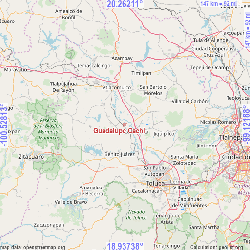
| Upper-left | 20.26211°, | -100.52813° |
| Center: | 19.60111°, | -99.825° |
| Lower-right: | 18.93738°, | -99.12188° |
| Map W x H: | 147.3×147.3 km | = 91.5×91.5mi |
| max Lat: | 32.7° ⇑51.9% North |
| Guadalupe Cachi: | 19.60111° |
| min Lat: | ⇓48.1% South 14.53588° |
| min Long | Guadalupe Cachi | max Long |
| -117.105° | -99.825° | -86.73105° |
| W 38.2%⇐ | ⇒61.8% E |
Elevation
Elevation of Guadalupe Cachi is 2540 m = 8333 ft, and this is 1286.3 m = 4220 ft above average elevation for this country.
| Max E: |
3497 m = 11473 ft | 6.8% |
| Guadalupe Cachi | 2540 m 8333 ft | |
| Avg. | 1253.7 m = 4113 ft | |
Min E: |
-1 m = -3 ft | 93.2% |
See also: Mexico elevation on elevation.city.
Geographical zone
Guadalupe Cachi is located in North Torrid zone (between Equator and Tropic of Cancer). Distance of this Northern Tropic circle is 426.5 km =265 mi to North.| Distance of | km | miles | from Guadalupe Cachi |
|---|---|---|---|
| North Pole | 7827.6 | 4863.8 | to North |
| Arctic Circle | 5221.7 | 3244.6 | to North |
| Tropic Cancer | 426.5 | 265 | to North |
| Equator | 2179.4 | 1354.2 | to South |


Nearby cities:
15 places around Guadalupe Cachi: (largest is in red/bold)
• Dolores Enyege
4.3 km =2.7 mi,  214°
214°
• Emiliano Zapata (Santo Domingo)
4.5 km =2.8 mi,  121°
121°
• La Concepción Enyege
4.4 km =2.7 mi,  202°
202°
• San Andrés del Pedregal
5.1 km =3.2 mi,  243°
243°
• San Antonio de los Remedios
6 km =3.7 mi,  313°
313°
• San Francisco de Guzmán
5.7 km =3.5 mi,  67°
67°
• San Ignacio del Pedregal
2.9 km =1.8 mi,  282°
282°
• San José del Río
3.3 km =2.1 mi,  11°
11°
• San Juan de las Manzanas
5.7 km =3.5 mi,  194°
194°
• San Mateo Ixtlahuaca
2.6 km =1.6 mi,  76°
76°
• San Miguel Enyege
5 km =3.1 mi,  226°
226°
• San Pablo de los Remedios
4.7 km =2.9 mi,  342°
342°
• San Pedro Los Baños
2.7 km =1.7 mi, 7°
• Santa Ana la Ladera
4.8 km =3 mi,  262°
262°
• Santo Domingo de Guzmán
4.8 km =3 mi,  100°
100°
Sources, notices
• [Note1] Compared only with cities in Mexico existing in our database
• [Src1] Map data: © OpenStreetMap contributors (CC-BY-SA)
• [Src2] Other city data from geonames.org with taken over terms of usage.
• [Src3] Geographical zone / Annual Mean Temperature by Robert A. Rohde @ Wikipedia
