San Jerónimo Sosola geodata
San Jerónimo Sosola (Oaxaca) is a seat of a second-order administrative division; located in Mexico in America/Mexico_City (GMT-6) time zone. With population of 95 people, there are 16897 cities with bigger population in this country. Compared to other cities in Mexico, 84.5% of cities are located further ↑North; 74.4% of cities are located further ←West and 70.2% of cities have lower elevation than San Jerónimo Sosola. Note1


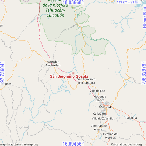
San Jerónimo Sosola GPS coordinates[2]
17° 22' 0.66" North, 97° 1' 58.476" West
| Map corner | latitude | longitude |
|---|---|---|
| Upper-left | 18.03668°, | -97.73604° |
| Center: | 17.36685°, | -97.03291° |
| Lower-right: | 16.69456°, | -96.32979° |
| Map W x H: | 149.2×149.2 km | = 92.7×92.7mi |
| max Lat: | 32.7° ⇑84.5% North |
| San Jerónimo Sosola: | 17.36685° |
| min Lat: | ⇓15.5% South 14.53588° |
| min Long | San Jerónimo S | max Long |
| -117.105° | -97.03291° | -86.73105° |
| W 74.4%⇐ | ⇒25.6% E |
Elevation
Elevation of San Jerónimo Sosola is 1929 m = 6329 ft, and this is 675.3 m = 2216 ft above average elevation for this country.
| Max E: |
3497 m = 11473 ft | 29.8% |
| San Jerónimo Sosola | 1929 m 6329 ft | |
| Avg. | 1253.7 m = 4113 ft | |
Min E: |
-1 m = -3 ft | 70.2% |
See also: Mexico elevation on elevation.city.
Geographical zone
San Jerónimo Sosola is located in North Torrid zone (between Equator and Tropic of Cancer). Distance of this Northern Tropic circle is 674.9 km =419.4 mi to North.| Distance of | km | miles | from San Jerónimo Sosola |
|---|---|---|---|
| North Pole | 8076 | 5018.2 | to North |
| Arctic Circle | 5470.2 | 3399 | to North |
| Tropic Cancer | 674.9 | 419.4 | to North |
| Equator | 1931 | 1199.9 | to South |


Nearby cities:
15 places around San Jerónimo Sosola: (largest is in red/bold)
• Asunción Nochixtlán
22.9 km =14.2 mi,  296°
296°
• Magdalena Jaltepec
20.6 km =12.8 mi,  256°
256°
• Magdalena Zahuatlán
20.8 km =12.9 mi,  277°
277°
• San Francisco Jaltepetongo
24.7 km =15.3 mi,  274°
274°
• San Francisco Telixtlahuaca
15.6 km =9.7 mi,  119°
119°
• San Juan Bautista Jayacatlán
23.2 km =14.4 mi,  73°
73°
• San Mateo Sosola
9.8 km =6.1 mi,  292°
292°
• San Pablo Huitzo
18.5 km =11.5 mi, 122°
• San Pedro Coxcaltepec Cántaros
18.5 km =11.5 mi,  322°
322°
• Santa Cruz Lachixolana
24.4 km =15.2 mi,  129°
129°
• Santiago Huauclilla
10.3 km =6.4 mi,  335°
335°
• Santiago Nacaltepec
19.8 km =12.3 mi,  37°
37°
• Santiago Suchilquitongo
20.7 km =12.9 mi, 127°
• Santiago Tenango
5.5 km =3.4 mi,  147°
147°
• Santo Domingo Tlaltinango
24.3 km =15.1 mi, 125°
Sources, notices
• [Note1] Compared only with cities in Mexico existing in our database
• [Src1] Map data: © OpenStreetMap contributors (CC-BY-SA)
• [Src2] Other city data from geonames.org with taken over terms of usage.
• [Src3] Geographical zone / Annual Mean Temperature by Robert A. Rohde @ Wikipedia
