San Pedro Coxcaltepec Cántaros geodata
San Pedro Coxcaltepec Cántaros (Oaxaca) is a seat of a second-order administrative division; located in Mexico in America/Mexico_City (GMT-6) time zone. With population of 207 people, there are 16885 cities with bigger population in this country. Compared to other cities in Mexico, 83.1% of cities are located further ↑North; 73.1% of cities are located further ←West and 85.3% of cities have lower elevation than San Pedro Coxcaltepec Cántaros. Note1
Current local time in San Pedro Coxcaltepec Cántaros:
10:04 AM, MondayDifference from your time zone: hours


San Pedro Coxcaltepec Cántaros GPS coordinates[2]
17° 29' 57.588" North, 97° 8' 16.872" West
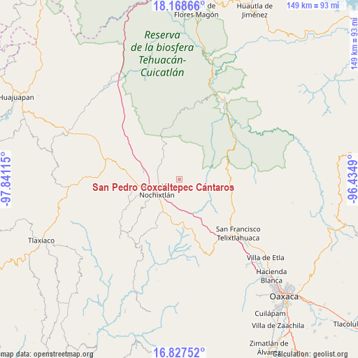
| Map corner | latitude | longitude |
|---|---|---|
| Upper-left | 18.16866°, | -97.84115° |
| Center: | 17.49933°, | -97.13802° |
| Lower-right: | 16.82752°, | -96.4349° |
| Map W x H: | 149.1×149.1 km | = 92.6×92.6mi |
| max Lat: | 32.7° ⇑83.1% North |
| San Pedro Coxcaltepec Cántaros: | 17.49933° |
| min Lat: | ⇓16.9% South 14.53588° |
| min Long | San Pedro Coxca | max Long |
| -117.105° | -97.13802° | -86.73105° |
| W 73.1%⇐ | ⇒26.9% E |
Elevation
Elevation of San Pedro Coxcaltepec Cántaros is 2264 m = 7428 ft, and this is 1010.3 m = 3315 ft above average elevation for this country.
| Max E: |
3497 m = 11473 ft | 14.7% |
| San Pedro Coxcaltepec Cántaros | 2264 m 7428 ft | |
| Avg. | 1253.7 m = 4113 ft | |
Min E: |
-1 m = -3 ft | 85.3% |
See also: Mexico elevation on elevation.city.
Geographical zone
San Pedro Coxcaltepec Cántaros is located in North Torrid zone (between Equator and Tropic of Cancer). Distance of this Northern Tropic circle is 660.2 km =410.2 mi to North.| Distance of | km | miles | from San Pedro Coxcaltepec Cántaros |
|---|---|---|---|
| North Pole | 8061.3 | 5009.1 | to North |
| Arctic Circle | 5455.4 | 3389.8 | to North |
| Tropic Cancer | 660.2 | 410.2 | to North |
| Equator | 1945.7 | 1209 | to South |


Nearby cities:
15 places around San Pedro Coxcaltepec Cántaros: (largest is in red/bold)
• Apoala
16.6 km =10.3 mi,  0°
0°
• Asunción Nochixtlán
10.3 km =6.4 mi,  244°
244°
• Chicahua
16.4 km =10.2 mi,  338°
338°
• El Fortín Alto
13.7 km =8.5 mi,  332°
332°
• Magdalena Zahuatlán
15.4 km =9.6 mi,  217°
217°
• San Andrés Sinaxtla
15.7 km =9.8 mi,  257°
257°
• San Francisco Jaltepetongo
18.4 km =11.4 mi,  226°
226°
• San Juan Sayultepec
16.4 km =10.2 mi,  251°
251°
• San Mateo Etlatongo
17.1 km =10.6 mi, 237°
• San Mateo Sosola
11.2 km =7 mi,  169°
169°
• San Miguel Tecomatlán
18.1 km =11.2 mi, 229°
• Santa María Apazco
15.5 km =9.6 mi,  14°
14°
• Santa María Chachoápam
15.8 km =9.8 mi,  280°
280°
• Santiago Huauclilla
8.7 km =5.4 mi,  127°
127°
• Yucuita
14 km =8.7 mi, 275°
Sources, notices
• [Note1] Compared only with cities in Mexico existing in our database
• [Src1] Map data: © OpenStreetMap contributors (CC-BY-SA)
• [Src2] Other city data from geonames.org with taken over terms of usage.
• [Src3] Geographical zone / Annual Mean Temperature by Robert A. Rohde @ Wikipedia
