Llano Nuevo geodata
Llano Nuevo (Oaxaca) is a populated place; located in Mexico in America/Mexico_City (GMT-6) time zone. With population of 911 people, there are 9575 cities with bigger population in this country. Compared to other cities in Mexico, 93.6% of cities are located further ↑North; 69.4% of cities are located further ←West and 60.4% of cities have higher elevation than Llano Nuevo. Note1


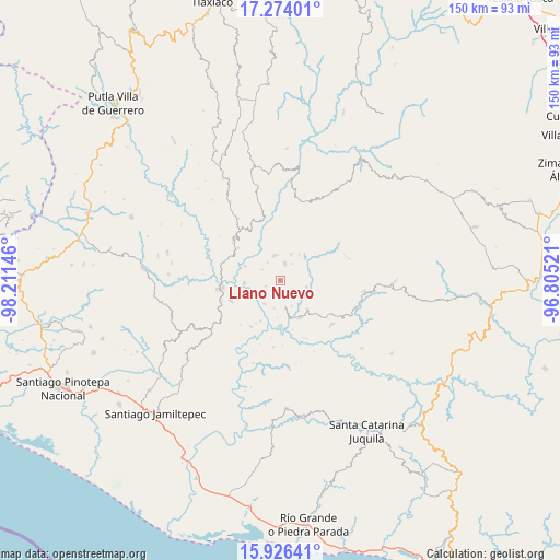
Llano Nuevo GPS coordinates[2]
16° 36' 5.004" North, 97° 30' 29.988" West
| Map corner | latitude | longitude |
|---|---|---|
| Upper-left | 17.27401°, | -98.21146° |
| Center: | 16.60139°, | -97.50833° |
| Lower-right: | 15.92641°, | -96.80521° |
| Map W x H: | 149.8×149.8 km | = 93.1×93.1mi |
| max Lat: | 32.7° ⇑93.6% North |
| Llano Nuevo: | 16.60139° |
| min Lat: | ⇓6.4% South 14.53588° |
| min Long | Llano Nuevo | max Long |
| -117.105° | -97.50833° | -86.73105° |
| W 69.4%⇐ | ⇒30.6% E |
Elevation
Elevation of Llano Nuevo is 978 m = 3209 ft, and this is 275.7 m = 905 ft below average elevation for this country.
| Max E: |
3497 m = 11473 ft | 60.4% |
| Avg. | 1253.7 m = 4113 ft | |
| Llano Nuevo | 978 m = 3209 ft | |
Min E: |
-1 m = -3 ft | 39.6% |
See also: Mexico elevation on elevation.city.
Geographical zone
Llano Nuevo is located in North Torrid zone (between Equator and Tropic of Cancer). Distance of this Northern Tropic circle is 760 km =472.2 mi to North.| Distance of | km | miles | from Llano Nuevo |
|---|---|---|---|
| North Pole | 8161.2 | 5071.1 | to North |
| Arctic Circle | 5555.3 | 3451.9 | to North |
| Tropic Cancer | 760 | 472.2 | to North |
| Equator | 1845.9 | 1147 | to South |


Nearby cities:
15 places around Llano Nuevo: (largest is in red/bold)
• Colonia de Jesús (La Cucaracha)
5.4 km =3.4 mi,  32°
32°
• El Carrizal
10.4 km =6.5 mi,  138°
138°
• El Limoncillo
8.7 km =5.4 mi,  180°
180°
• El Portillo
13.6 km =8.5 mi,  133°
133°
• Mano del Señor
7.1 km =4.4 mi,  105°
105°
• Piedra Grande
5 km =3.1 mi,  215°
215°
• Piedra del Tambor
6.6 km =4.1 mi,  347°
347°
• Pueblo Viejo
14.1 km =8.8 mi,  246°
246°
• Quinicuena
8 km =5 mi,  191°
191°
• San Jacinto Tlacotepec
15.8 km =9.8 mi,  124°
124°
• San José
11.6 km =7.2 mi,  152°
152°
• San Mateo Yucutindoo
15.3 km =9.5 mi,  9°
9°
• San Pedro del Río
10.6 km =6.6 mi,  164°
164°
• Santa Cruz Zenzontepec
7.6 km =4.7 mi,  169°
169°
• Santiago Amoltepec
4.7 km =2.9 mi,  15°
15°
Sources, notices
• [Note1] Compared only with cities in Mexico existing in our database
• [Src1] Map data: © OpenStreetMap contributors (CC-BY-SA)
• [Src2] Other city data from geonames.org with taken over terms of usage.
• [Src3] Geographical zone / Annual Mean Temperature by Robert A. Rohde @ Wikipedia
