El Carrizal geodata
El Carrizal (Oaxaca) is a populated place; located in Mexico in America/Mexico_City (GMT-6) time zone. With population of 591 people, there are 14530 cities with bigger population in this country. Compared to other cities in Mexico, 94.1% of cities are located further ↑North; 70.1% of cities are located further ←West and 59.3% of cities have higher elevation than El Carrizal. Note1


El Carrizal GPS coordinates[2]
16° 31' 55.632" North, 97° 26' 35.808" West
| Map corner | latitude | longitude |
|---|---|---|
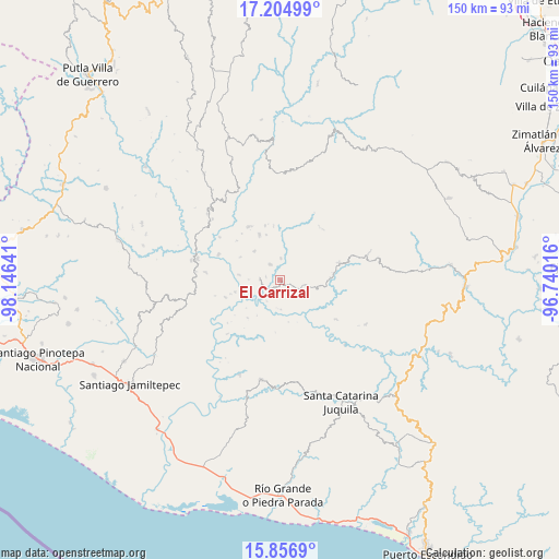
| Upper-left | 17.20499°, | -98.14641° |
| Center: | 16.53212°, | -97.44328° |
| Lower-right: | 15.8569°, | -96.74016° |
| Map W x H: | 149.9×149.9 km | = 93.1×93.1mi |
| max Lat: | 32.7° ⇑94.1% North |
| El Carrizal: | 16.53212° |
| min Lat: | ⇓5.9% South 14.53588° |
| min Long | El Carrizal | max Long |
| -117.105° | -97.44328° | -86.73105° |
| W 70.1%⇐ | ⇒29.9% E |
Elevation
Elevation of El Carrizal is 1033 m = 3389 ft, and this is 220.7 m = 724 ft below average elevation for this country.
| Max E: |
3497 m = 11473 ft | 59.3% |
| Avg. | 1253.7 m = 4113 ft | |
| El Carrizal | 1033 m = 3389 ft | |
Min E: |
-1 m = -3 ft | 40.7% |
See also: Mexico elevation on elevation.city.
Geographical zone
El Carrizal is located in North Torrid zone (between Equator and Tropic of Cancer). Distance of this Northern Tropic circle is 767.7 km =477 mi to North.| Distance of | km | miles | from El Carrizal |
|---|---|---|---|
| North Pole | 8168.9 | 5075.9 | to North |
| Arctic Circle | 5563 | 3456.7 | to North |
| Tropic Cancer | 767.7 | 477 | to North |
| Equator | 1838.2 | 1142.2 | to South |


Nearby cities:
15 places around El Carrizal: (largest is in red/bold)
• Colonia de Jesús (La Cucaracha)
12.9 km =8 mi,  341°
341°
• Cuajinicuil
7.9 km =4.9 mi,  120°
120°
• El Limoncillo
7.1 km =4.4 mi,  261°
261°
• El Portillo
3.4 km =2.1 mi, 119°
• La Conchita
7.7 km =4.8 mi,  184°
184°
• Llano Nuevo
10.4 km =6.5 mi,  318°
318°
• Mano del Señor
5.8 km =3.6 mi,  359°
359°
• Piedra Grande
10.5 km =6.5 mi,  290°
290°
• Piedra del Tambor
16.4 km =10.2 mi,  329°
329°
• Quinicuena
8.6 km =5.3 mi,  269°
269°
• San Jacinto Tlacotepec
6.2 km =3.9 mi,  101°
101°
• San José
3 km =1.9 mi,  211°
211°
• San Pedro del Río
4.7 km =2.9 mi,  238°
238°
• Santa Cruz Zenzontepec
5.6 km =3.5 mi, 272°
• Santiago Amoltepec
13.5 km =8.4 mi, 335°
Sources, notices
• [Note1] Compared only with cities in Mexico existing in our database
• [Src1] Map data: © OpenStreetMap contributors (CC-BY-SA)
• [Src2] Other city data from geonames.org with taken over terms of usage.
• [Src3] Geographical zone / Annual Mean Temperature by Robert A. Rohde @ Wikipedia
