San Francisco Oxtotilpan geodata
San Francisco Oxtotilpan (State of Mexico) is a populated place; located in Mexico in America/Mexico_City (GMT-6) time zone. With population of 1,435 people, there are 6019 cities with bigger population in this country. Compared to other cities in Mexico, 61.8% of cities are located further ↑North; 62.6% of cities are located further →East and 96.3% of cities have lower elevation than San Francisco Oxtotilpan. Note1
Current local time in San Francisco Oxtotilpan:
11:19 AM, MondayDifference from your time zone: hours


San Francisco Oxtotilpan GPS coordinates[2]
19° 10' 9.336" North, 99° 54' 9.828" West
| Map corner | latitude | longitude |
|---|---|---|
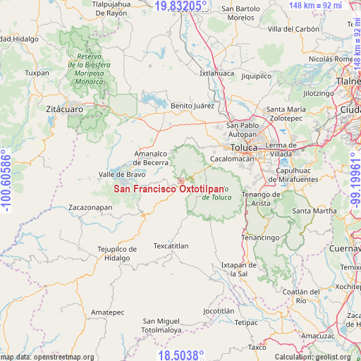
| Upper-left | 19.83205°, | -100.60586° |
| Center: | 19.16926°, | -99.90273° |
| Lower-right: | 18.5038°, | -99.19961° |
| Map W x H: | 147.7×147.7 km | = 91.8×91.8mi |
| max Lat: | 32.7° ⇑61.8% North |
| San Francisco Oxtotilpan: | 19.16926° |
| min Lat: | ⇓38.2% South 14.53588° |
| min Long | San Francisco O | max Long |
| -117.105° | -99.90273° | -86.73105° |
| W 37.4%⇐ | ⇒62.6% E |
Elevation
Elevation of San Francisco Oxtotilpan is 2642 m = 8668 ft, and this is 1388.3 m = 4555 ft above average elevation for this country.
| Max E: |
3497 m = 11473 ft | 3.7% |
| San Francisco Oxtotilpan | 2642 m 8668 ft | |
| Avg. | 1253.7 m = 4113 ft | |
Min E: |
-1 m = -3 ft | 96.3% |
See also: Mexico elevation on elevation.city.
Geographical zone
San Francisco Oxtotilpan is located in North Torrid zone (between Equator and Tropic of Cancer). Distance of this Northern Tropic circle is 474.5 km =294.8 mi to North.| Distance of | km | miles | from San Francisco Oxtotilpan |
|---|---|---|---|
| North Pole | 7875.6 | 4893.7 | to North |
| Arctic Circle | 5269.8 | 3274.5 | to North |
| Tropic Cancer | 474.5 | 294.8 | to North |
| Equator | 2131.4 | 1324.4 | to South |


Nearby cities:
15 places around San Francisco Oxtotilpan: (largest is in red/bold)
• Agua Bendita
12.4 km =7.7 mi,  338°
338°
• Buenavista
9.1 km =5.7 mi,  64°
64°
• Cerro La Calera
9.2 km =5.7 mi,  80°
80°
• El Contadero de Matamoros
12.3 km =7.6 mi,  52°
52°
• La Comunidad
5.6 km =3.5 mi,  214°
214°
• La Peñuela
5.2 km =3.2 mi,  99°
99°
• Loma Alta
10.1 km =6.3 mi,  88°
88°
• Los Ocotes
10.1 km =6.3 mi,  196°
196°
• Los Saucos
10.1 km =6.3 mi,  267°
267°
• Raíces
10.3 km =6.4 mi, 94°
• San Antonio Albarranes
6.7 km =4.2 mi, 212°
• San Martín Tequesquipan (Tequesquipan)
13.2 km =8.2 mi, 200°
• San Mateo Almomoloha
4.3 km =2.7 mi,  232°
232°
• San Miguel Oxtotilpan
2.9 km =1.8 mi,  165°
165°
• Santanas
7.1 km =4.4 mi,  220°
220°
Sources, notices
• [Note1] Compared only with cities in Mexico existing in our database
• [Src1] Map data: © OpenStreetMap contributors (CC-BY-SA)
• [Src2] Other city data from geonames.org with taken over terms of usage.
• [Src3] Geographical zone / Annual Mean Temperature by Robert A. Rohde @ Wikipedia
