Los Saucos geodata
Los Saucos (State of Mexico) is a populated place; located in Mexico in America/Mexico_City (GMT-6) time zone. With population of 1,458 people, there are 5926 cities with bigger population in this country. Compared to other cities in Mexico, 61.9% of cities are located further ↑North; 64% of cities are located further →East and 93.4% of cities have lower elevation than Los Saucos. Note1


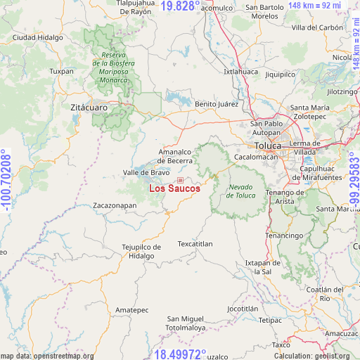
Los Saucos GPS coordinates[2]
19° 9' 54.72" North, 99° 59' 56.22" West
| Map corner | latitude | longitude |
|---|---|---|
| Upper-left | 19.828°, | -100.70208° |
| Center: | 19.1652°, | -99.99895° |
| Lower-right: | 18.49972°, | -99.29583° |
| Map W x H: | 147.7×147.7 km | = 91.8×91.8mi |
| max Lat: | 32.7° ⇑61.9% North |
| Los Saucos: | 19.1652° |
| min Lat: | ⇓38.1% South 14.53588° |
| min Long | Los Saucos | max Long |
| -117.105° | -99.99895° | -86.73105° |
| W 36%⇐ | ⇒64% E |
Elevation
Elevation of Los Saucos is 2549 m = 8363 ft, and this is 1295.3 m = 4250 ft above average elevation for this country.
| Max E: |
3497 m = 11473 ft | 6.6% |
| Los Saucos | 2549 m 8363 ft | |
| Avg. | 1253.7 m = 4113 ft | |
Min E: |
-1 m = -3 ft | 93.4% |
See also: Mexico elevation on elevation.city.
Geographical zone
Los Saucos is located in North Torrid zone (between Equator and Tropic of Cancer). Distance of this Northern Tropic circle is 474.9 km =295.1 mi to North.| Distance of | km | miles | from Los Saucos |
|---|---|---|---|
| North Pole | 7876.1 | 4894 | to North |
| Arctic Circle | 5270.2 | 3274.7 | to North |
| Tropic Cancer | 474.9 | 295.1 | to North |
| Equator | 2131 | 1324.1 | to South |


Nearby cities:
15 places around Los Saucos: (largest is in red/bold)
• Amanalco de Becerra
10.1 km =6.3 mi,  347°
347°
• Cuadrilla de Dolores
7.9 km =4.9 mi,  249°
249°
• La Compañía
8.5 km =5.3 mi,  269°
269°
• La Comunidad
8 km =5 mi,  120°
120°
• Mesa de Jaimes
11.2 km =7 mi, 268°
• San Antonio Albarranes
8.4 km =5.2 mi,  128°
128°
• San Bartolo
10.5 km =6.5 mi,  327°
327°
• San Francisco Oxtotilpan
10.1 km =6.3 mi,  87°
87°
• San Jerónimo
8.9 km =5.5 mi,  344°
344°
• San Juan
9.7 km =6 mi, 339°
• San Lucas
10.5 km =6.5 mi,  355°
355°
• San Lucas del Pulque
7.7 km =4.8 mi,  203°
203°
• San Mateo Almomoloha
7.1 km =4.4 mi,  107°
107°
• San Miguel Oxtotilpan
11.1 km =6.9 mi,  102°
102°
• Santanas
7.4 km =4.6 mi, 131°
Sources, notices
• [Note1] Compared only with cities in Mexico existing in our database
• [Src1] Map data: © OpenStreetMap contributors (CC-BY-SA)
• [Src2] Other city data from geonames.org with taken over terms of usage.
• [Src3] Geographical zone / Annual Mean Temperature by Robert A. Rohde @ Wikipedia
