Loma Alta geodata
Loma Alta (State of Mexico) is a populated place; located in Mexico in America/Mexico_City (GMT-6) time zone. With population of 530 people, there are 15970 cities with bigger population in this country. Compared to other cities in Mexico, 61.8% of cities are located further ↑North; 61.5% of cities are located further →East and 100% of cities have lower elevation than Loma Alta. Note1


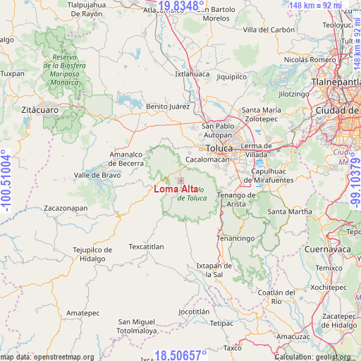
Loma Alta GPS coordinates[2]
19° 10' 19.272" North, 99° 48' 24.876" West
| Map corner | latitude | longitude |
|---|---|---|
| Upper-left | 19.8348°, | -100.51004° |
| Center: | 19.17202°, | -99.80691° |
| Lower-right: | 18.50657°, | -99.10379° |
| Map W x H: | 147.7×147.7 km | = 91.8×91.8mi |
| max Lat: | 32.7° ⇑61.8% North |
| Loma Alta: | 19.17202° |
| min Lat: | ⇓38.2% South 14.53588° |
| min Long | Loma Alta | max Long |
| -117.105° | -99.80691° | -86.73105° |
| W 38.5%⇐ | ⇒61.5% E |
Elevation
Elevation of Loma Alta is 3449 m = 11316 ft, and this is 2195.3 m = 7202 ft above average elevation for this country.
| Max E: |
3497 m = 11473 ft | 0% |
| Loma Alta | 3449 m 11316 ft | |
| Avg. | 1253.7 m = 4113 ft | |
Min E: |
-1 m = -3 ft | 100% |
See also: Mexico elevation on elevation.city.
Geographical zone
Loma Alta is located in North Torrid zone (between Equator and Tropic of Cancer). Distance of this Northern Tropic circle is 474.2 km =294.7 mi to North.| Distance of | km | miles | from Loma Alta |
|---|---|---|---|
| North Pole | 7875.3 | 4893.5 | to North |
| Arctic Circle | 5269.4 | 3274.3 | to North |
| Tropic Cancer | 474.2 | 294.7 | to North |
| Equator | 2131.7 | 1324.6 | to South |


Nearby cities:
15 places around Loma Alta: (largest is in red/bold)
• Buenavista
4.1 km =2.5 mi,  332°
332°
• Cerro La Calera
1.6 km =1 mi,  320°
320°
• Ciendabajo (Hacienda de Abajo)
11.7 km =7.3 mi,  12°
12°
• Colonia Cuauhtémoc
8.9 km =5.5 mi, 6°
• Colonia Morelos
10.5 km =6.5 mi,  37°
37°
• El Contadero de Matamoros
7.3 km =4.5 mi,  357°
357°
• La Peñuela
5.1 km =3.2 mi,  256°
256°
• Ojo de Agua
6.2 km =3.9 mi, 37°
• Raíces
1.2 km =0.7 mi,  171°
171°
• Recibitas (El Remolino)
8.5 km =5.3 mi, 35°
• San Francisco Oxtotilpan
10.1 km =6.3 mi,  268°
268°
• San Juan de las Huertas
9.8 km =6.1 mi,  31°
31°
• San Miguel Oxtotilpan
9.9 km =6.2 mi,  251°
251°
• San Pedro Tejalpa
9.7 km =6 mi, 9°
• Tejalpa
9.9 km =6.2 mi, 25°
Sources, notices
• [Note1] Compared only with cities in Mexico existing in our database
• [Src1] Map data: © OpenStreetMap contributors (CC-BY-SA)
• [Src2] Other city data from geonames.org with taken over terms of usage.
• [Src3] Geographical zone / Annual Mean Temperature by Robert A. Rohde @ Wikipedia
