San Antonio Rayón geodata
San Antonio Rayón (Tamaulipas) is a populated place; located in Mexico in America/Mexico_City (GMT-6) time zone. With population of 1,425 people, there are 6062 cities with bigger population in this country. Compared to other cities in Mexico, 86.4% of cities are located further ↓South; 58.4% of cities are located further ←West and 90.4% of cities have higher elevation than San Antonio Rayón. Note1


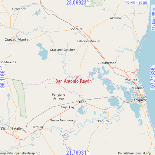
San Antonio Rayón GPS coordinates[2]
22° 25' 14.844" North, 98° 24' 59.328" West
| Map corner | latitude | longitude |
|---|---|---|
| Upper-left | 23.06923°, | -99.11961° |
| Center: | 22.42079°, | -98.41648° |
| Lower-right: | 21.76931°, | -97.71336° |
| Map W x H: | 144.5×144.5 km | = 89.8×89.8mi |
| max Lat: | 32.7° ⇑13.6% North |
| San Antonio Rayón: | 22.42079° |
| min Lat: | ⇓86.4% South 14.53588° |
| min Long | San Antonio Ray | max Long |
| -117.105° | -98.41648° | -86.73105° |
| W 58.4%⇐ | ⇒41.6% E |
Elevation
Elevation of San Antonio Rayón is 23 m = 75 ft, and this is 1230.7 m = 4038 ft below average elevation for this country.
| Max E: |
3497 m = 11473 ft | 90.4% |
| Avg. | 1253.7 m = 4113 ft | |
| San Antonio Rayón | 23 m = 75 ft | |
Min E: |
-1 m = -3 ft | 9.6% |
See also: Mexico elevation on elevation.city.
Geographical zone
San Antonio Rayón is located in North Torrid zone (between Equator and Tropic of Cancer). Distance of this Northern Tropic circle is 113 km =70.2 mi to North.| Distance of | km | miles | from San Antonio Rayón |
|---|---|---|---|
| North Pole | 7514.1 | 4669 | to North |
| Arctic Circle | 4908.2 | 3049.8 | to North |
| Tropic Cancer | 113 | 70.2 | to North |
| Equator | 2493 | 1549.1 | to South |


Nearby cities:
15 places around San Antonio Rayón: (largest is in red/bold)
• Adolfo Ruiz Cortines
22.1 km =13.7 mi,  347°
347°
• Aurelio Manrique
28.3 km =17.6 mi,  238°
238°
• Chijol Diecisiete
23.9 km =14.9 mi,  142°
142°
• Colonia Piloto
10.6 km =6.6 mi,  149°
149°
• Estación Velazco
29.6 km =18.4 mi,  210°
210°
• Graciano Sánchez
29.6 km =18.4 mi,  331°
331°
• Guayalejo
8 km =5 mi, 238°
• Los Aztecas
22.2 km =13.8 mi,  293°
293°
• López Rayón
9.6 km =6 mi, 332°
• Nueva Apolonia
23.6 km =14.7 mi, 291°
• Nuevo Tantoán
15.6 km =9.7 mi,  272°
272°
• Ponciano Arriaga
25.1 km =15.6 mi,  225°
225°
• Pujal-Coy
28.7 km =17.8 mi,  198°
198°
• Tantoyuquita
19.5 km =12.1 mi,  313°
313°
• Ébano
22.9 km =14.2 mi,  169°
169°
Sources, notices
• [Note1] Compared only with cities in Mexico existing in our database
• [Src1] Map data: © OpenStreetMap contributors (CC-BY-SA)
• [Src2] Other city data from geonames.org with taken over terms of usage.
• [Src3] Geographical zone / Annual Mean Temperature by Robert A. Rohde @ Wikipedia
