Graciano Sánchez geodata
Graciano Sánchez (Tamaulipas) is a populated place; located in Mexico in America/Monterrey (GMT-6) time zone. With population of 4,426 people, there are 2076 cities with bigger population in this country. Compared to other cities in Mexico, 87.2% of cities are located further ↓South; 56.6% of cities are located further ←West and 85.7% of cities have higher elevation than Graciano Sánchez. Note1


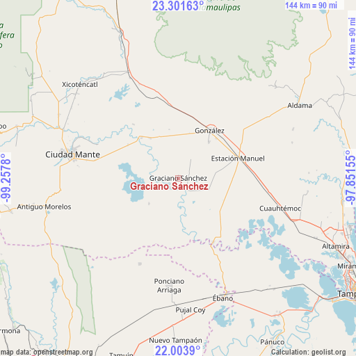
Graciano Sánchez GPS coordinates[2]
22° 39' 15.48" North, 98° 33' 16.812" West
| Map corner | latitude | longitude |
|---|---|---|
| Upper-left | 23.30163°, | -99.2578° |
| Center: | 22.6543°, | -98.55467° |
| Lower-right: | 22.0039°, | -97.85155° |
| Map W x H: | 144.3×144.3 km | = 89.7×89.7mi |
| max Lat: | 32.7° ⇑12.8% North |
| Graciano Sánchez: | 22.6543° |
| min Lat: | ⇓87.2% South 14.53588° |
| min Long | Graciano Sánch | max Long |
| -117.105° | -98.55467° | -86.73105° |
| W 56.6%⇐ | ⇒43.4% E |
Elevation
Elevation of Graciano Sánchez is 40 m = 131 ft, and this is 1213.7 m = 3982 ft below average elevation for this country.
| Max E: |
3497 m = 11473 ft | 85.7% |
| Avg. | 1253.7 m = 4113 ft | |
| Graciano Sánchez | 40 m = 131 ft | |
Min E: |
-1 m = -3 ft | 14.3% |
See also: Mexico elevation on elevation.city.
Geographical zone
Graciano Sánchez is located in North Torrid zone (between Equator and Tropic of Cancer). Distance of this Northern Tropic circle is 87 km =54.1 mi to North.| Distance of | km | miles | from Graciano Sánchez |
|---|---|---|---|
| North Pole | 7488.1 | 4652.9 | to North |
| Arctic Circle | 4882.3 | 3033.7 | to North |
| Tropic Cancer | 87 | 54.1 | to North |
| Equator | 2518.9 | 1565.2 | to South |


Nearby cities:
15 places around Graciano Sánchez: (largest is in red/bold)
• Adolfo Ruiz Cortines
10.5 km =6.5 mi,  114°
114°
• El Camotero Dos
15.7 km =9.8 mi,  228°
228°
• González
23.3 km =14.5 mi,  34°
34°
• Los Aztecas
18.1 km =11.2 mi,  199°
199°
• López Rayón
20 km =12.4 mi,  150°
150°
• Magdaleno Aguilar
29.4 km =18.3 mi,  211°
211°
• Magiscatzin
22.2 km =13.8 mi,  318°
318°
• Nueva Apolonia
19.1 km =11.9 mi, 204°
• Nuevo Tantoán
25.4 km =15.8 mi,  183°
183°
• Plan de Ayala
25.2 km =15.7 mi,  239°
239°
• San Antonio Rayón
29.6 km =18.4 mi, 151°
• Santa Fe
19.2 km =11.9 mi,  40°
40°
• Tantoyuquita
12.5 km =7.8 mi, 179°
• Ursulo Galván
25.2 km =15.7 mi,  71°
71°
• Venustiano Carranza Dos
28.3 km =17.6 mi, 320°
Sources, notices
• [Note1] Compared only with cities in Mexico existing in our database
• [Src1] Map data: © OpenStreetMap contributors (CC-BY-SA)
• [Src2] Other city data from geonames.org with taken over terms of usage.
• [Src3] Geographical zone / Annual Mean Temperature by Robert A. Rohde @ Wikipedia
