El Ranchito y Refugio geodata
El Ranchito y Refugio (Tamaulipas) is a populated place; located in Mexico in America/Matamoros (GMT-5) time zone. With population of 972 people, there are 8937 cities with bigger population in this country. Compared to other cities in Mexico, 94.5% of cities are located further ↓South; 71% of cities are located further ←West and 97.5% of cities have higher elevation than El Ranchito y Refugio. Note1


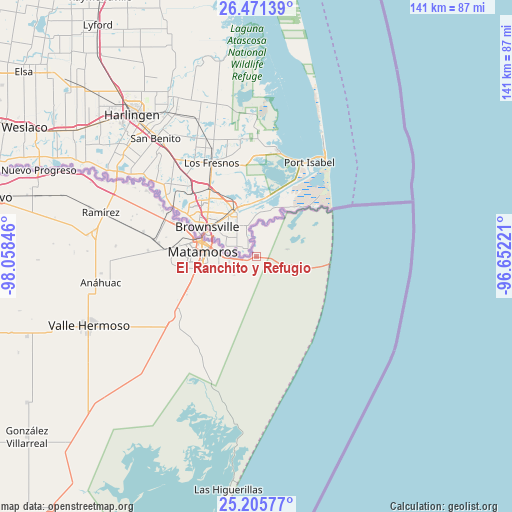
El Ranchito y Refugio GPS coordinates[2]
25° 50' 24.972" North, 97° 21' 19.188" West
| Map corner | latitude | longitude |
|---|---|---|
| Upper-left | 26.47139°, | -98.05846° |
| Center: | 25.84027°, | -97.35533° |
| Lower-right: | 25.20577°, | -96.65221° |
| Map W x H: | 140.7×140.7 km | = 87.4×87.4mi |
| max Lat: | 32.7° ⇑5.5% North |
| El Ranchito y Refugio: | 25.84027° |
| min Lat: | ⇓94.5% South 14.53588° |
| min Long | El Ranchito y R | max Long |
| -117.105° | -97.35533° | -86.73105° |
| W 71%⇐ | ⇒29% E |
Elevation
Elevation of El Ranchito y Refugio is 9 m = 30 ft, and this is 1244.7 m = 4084 ft below average elevation for this country.
| Max E: |
3497 m = 11473 ft | 97.5% |
| Avg. | 1253.7 m = 4113 ft | |
| El Ranchito y Refugio | 9 m = 30 ft | |
Min E: |
-1 m = -3 ft | 2.5% |
See also: Mexico elevation on elevation.city.
Geographical zone
El Ranchito y Refugio is located in North temperate zone (between Tropic of Cancer and the Arctic Circle). Distance of this Northern Tropic circle is 267.2 km =166 mi to South.| Distance of | km | miles | from El Ranchito y Refugio |
|---|---|---|---|
| North Pole | 7133.9 | 4432.8 | to North |
| Arctic Circle | 4528 | 2813.6 | to North |
| Tropic Cancer | 267.2 | 166 | to South |
| Equator | 2873.2 | 1785.3 | to South |


Nearby cities:
15 places around El Ranchito y Refugio: (largest is in red/bold)
• Anáhuac
42.5 km =26.4 mi,  260°
260°
• CEFERESO Número 3
27.8 km =17.3 mi,  271°
271°
• El Control
47.6 km =29.6 mi,  286°
286°
• El Galaneño
20.9 km =13 mi,  245°
245°
• El Longoreño
4.1 km =2.5 mi, 260°
• Empalme
45.6 km =28.3 mi,  278°
278°
• Guadalupe
24.9 km =15.5 mi, 292°
• Heroica Matamoros
15.5 km =9.6 mi, 286°
• Ignacio Manuel Altamirano
46.8 km =29.1 mi, 277°
• La Gloria
26.9 km =16.7 mi, 278°
• La Venada
24.4 km =15.2 mi, 256°
• Presidente Cárdenas
44.9 km =27.9 mi, 279°
• Ramírez
44.8 km =27.8 mi, 286°
• Santa Adelaida
29.7 km =18.5 mi, 272°
• Valle Hermoso
49.5 km =30.8 mi, 247°
Sources, notices
• [Note1] Compared only with cities in Mexico existing in our database
• [Src1] Map data: © OpenStreetMap contributors (CC-BY-SA)
• [Src2] Other city data from geonames.org with taken over terms of usage.
• [Src3] Geographical zone / Annual Mean Temperature by Robert A. Rohde @ Wikipedia
