El Longoreño geodata
El Longoreño (Tamaulipas) is a populated place; located in Mexico in America/Matamoros (GMT-5) time zone. With population of 676 people, there are 12846 cities with bigger population in this country. Compared to other cities in Mexico, 94.5% of cities are located further ↓South; 70.6% of cities are located further ←West and 95.7% of cities have higher elevation than El Longoreño. Note1


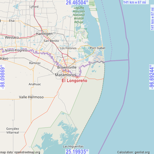
El Longoreño GPS coordinates[2]
25° 50' 2.004" North, 97° 23' 44.016" West
| Map corner | latitude | longitude |
|---|---|---|
| Upper-left | 26.46504°, | -98.09869° |
| Center: | 25.83389°, | -97.39556° |
| Lower-right: | 25.19935°, | -96.69244° |
| Map W x H: | 140.7×140.7 km | = 87.4×87.4mi |
| max Lat: | 32.7° ⇑5.5% North |
| El Longoreño: | 25.83389° |
| min Lat: | ⇓94.5% South 14.53588° |
| min Long | El Longoreño | max Long |
| -117.105° | -97.39556° | -86.73105° |
| W 70.6%⇐ | ⇒29.4% E |
Elevation
Elevation of El Longoreño is 12 m = 39 ft, and this is 1241.7 m = 4074 ft below average elevation for this country.
| Max E: |
3497 m = 11473 ft | 95.7% |
| Avg. | 1253.7 m = 4113 ft | |
| El Longoreño | 12 m = 39 ft | |
Min E: |
-1 m = -3 ft | 4.3% |
See also: Mexico elevation on elevation.city.
Geographical zone
El Longoreño is located in North temperate zone (between Tropic of Cancer and the Arctic Circle). Distance of this Northern Tropic circle is 266.5 km =165.6 mi to South.| Distance of | km | miles | from El Longoreño |
|---|---|---|---|
| North Pole | 7134.6 | 4433.2 | to North |
| Arctic Circle | 4528.7 | 2814 | to North |
| Tropic Cancer | 266.5 | 165.6 | to South |
| Equator | 2872.5 | 1784.9 | to South |


Nearby cities:
15 places around El Longoreño: (largest is in red/bold)
• Anáhuac
38.4 km =23.9 mi,  260°
260°
• CEFERESO Número 3
23.8 km =14.8 mi,  273°
273°
• El Control
44 km =27.3 mi,  288°
288°
• El Galaneño
17 km =10.6 mi,  241°
241°
• El Ranchito y Refugio
4.1 km =2.5 mi,  80°
80°
• Empalme
41.8 km =26 mi,  280°
280°
• Guadalupe
21.6 km =13.4 mi,  298°
298°
• Heroica Matamoros
12 km =7.5 mi, 295°
• Ignacio Manuel Altamirano
42.9 km =26.7 mi, 278°
• La Gloria
23.1 km =14.4 mi, 281°
• La Venada
20.4 km =12.7 mi, 256°
• Presidente Cárdenas
41 km =25.5 mi, 281°
• Ramírez
41.2 km =25.6 mi, 288°
• Santa Adelaida
25.8 km =16 mi, 275°
• Valle Hermoso
45.5 km =28.3 mi,  246°
246°
Sources, notices
• [Note1] Compared only with cities in Mexico existing in our database
• [Src1] Map data: © OpenStreetMap contributors (CC-BY-SA)
• [Src2] Other city data from geonames.org with taken over terms of usage.
• [Src3] Geographical zone / Annual Mean Temperature by Robert A. Rohde @ Wikipedia
