Piedra Labrada geodata
Piedra Labrada (Chiapas) is a populated place; located in Mexico in America/Mexico_City (GMT-6) time zone. With population of 1,115 people, there are 7795 cities with bigger population in this country. Compared to other cities in Mexico, 98.2% of cities are located further ↑North; 93.4% of cities are located further ←West and 66% of cities have higher elevation than Piedra Labrada. Note1


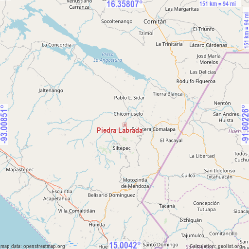
Piedra Labrada GPS coordinates[2]
15° 40' 56.136" North, 92° 18' 19.368" West
| Map corner | latitude | longitude |
|---|---|---|
| Upper-left | 16.35807°, | -93.00851° |
| Center: | 15.68226°, | -92.30538° |
| Lower-right: | 15.0042°, | -91.60226° |
| Map W x H: | 150.5×150.5 km | = 93.5×93.5mi |
| max Lat: | 32.7° ⇑98.2% North |
| Piedra Labrada: | 15.68226° |
| min Lat: | ⇓1.8% South 14.53588° |
| min Long | Piedra Labrada | max Long |
| -117.105° | -92.30538° | -86.73105° |
| W 93.4%⇐ | ⇒6.6% E |
Elevation
Elevation of Piedra Labrada is 634 m = 2080 ft, and this is 619.7 m = 2033 ft below average elevation for this country.
| Max E: |
3497 m = 11473 ft | 66% |
| Avg. | 1253.7 m = 4113 ft | |
| Piedra Labrada | 634 m = 2080 ft | |
Min E: |
-1 m = -3 ft | 34% |
See also: Mexico elevation on elevation.city.
Geographical zone
Piedra Labrada is located in North Torrid zone (between Equator and Tropic of Cancer). Distance of this Northern Tropic circle is 862.2 km =535.7 mi to North.| Distance of | km | miles | from Piedra Labrada |
|---|---|---|---|
| North Pole | 8263.4 | 5134.6 | to North |
| Arctic Circle | 5657.5 | 3515.4 | to North |
| Tropic Cancer | 862.2 | 535.7 | to North |
| Equator | 1743.7 | 1083.5 | to South |


Nearby cities:
15 places around Piedra Labrada: (largest is in red/bold)
• 20 de Noviembre
10 km =6.2 mi,  308°
308°
• Bella Vista
12.6 km =7.8 mi,  150°
150°
• Chicomuselo
7.3 km =4.5 mi,  18°
18°
• Emiliano Zapata
7.3 km =4.5 mi,  101°
101°
• La Hacienda
4.4 km =2.7 mi,  143°
143°
• La Reforma
11 km =6.8 mi,  74°
74°
• La Rinconada
10.7 km =6.6 mi,  157°
157°
• La Zacualpa
1.2 km =0.7 mi,  335°
335°
• Las Chicharras
10.2 km =6.3 mi, 97°
• Lázaro Cárdenas
6.7 km =4.2 mi,  54°
54°
• Monte Sinaí
6.6 km =4.1 mi,  276°
276°
• Nuevo Pacayal
2.7 km =1.7 mi,  203°
203°
• Pinada de Arriba
7.5 km =4.7 mi,  194°
194°
• San José las Chicharras
11.4 km =7.1 mi,  112°
112°
• Veinticuatro de Febrero
13.4 km =8.3 mi,  75°
75°
Sources, notices
• [Note1] Compared only with cities in Mexico existing in our database
• [Src1] Map data: © OpenStreetMap contributors (CC-BY-SA)
• [Src2] Other city data from geonames.org with taken over terms of usage.
• [Src3] Geographical zone / Annual Mean Temperature by Robert A. Rohde @ Wikipedia
