Chicomuselo geodata
Chicomuselo (Chiapas) is a seat of a second-order administrative division; located in Mexico in America/Mexico_City (GMT-6) time zone. With population of 5,938 people, there are 1569 cities with bigger population in this country. Compared to other cities in Mexico, 98% of cities are located further ↑North; 93.5% of cities are located further ←West and 66.8% of cities have higher elevation than Chicomuselo. Note1


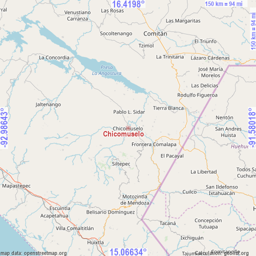
Chicomuselo GPS coordinates[2]
15° 44' 39.12" North, 92° 16' 59.88" West
| Map corner | latitude | longitude |
|---|---|---|
| Upper-left | 16.4198°, | -92.98643° |
| Center: | 15.7442°, | -92.2833° |
| Lower-right: | 15.06634°, | -91.58018° |
| Map W x H: | 150.5×150.5 km | = 93.5×93.5mi |
| max Lat: | 32.7° ⇑98% North |
| Chicomuselo: | 15.7442° |
| min Lat: | ⇓2% South 14.53588° |
| min Long | Chicomuselo | max Long |
| -117.105° | -92.2833° | -86.73105° |
| W 93.5%⇐ | ⇒6.5% E |
Elevation
Elevation of Chicomuselo is 597 m = 1959 ft, and this is 656.7 m = 2155 ft below average elevation for this country.
| Max E: |
3497 m = 11473 ft | 66.8% |
| Avg. | 1253.7 m = 4113 ft | |
| Chicomuselo | 597 m = 1959 ft | |
Min E: |
-1 m = -3 ft | 33.2% |
See also: Mexico elevation on elevation.city.
Geographical zone
Chicomuselo is located in North Torrid zone (between Equator and Tropic of Cancer). Distance of this Northern Tropic circle is 855.3 km =531.5 mi to North.| Distance of | km | miles | from Chicomuselo |
|---|---|---|---|
| North Pole | 8256.5 | 5130.3 | to North |
| Arctic Circle | 5650.6 | 3511.1 | to North |
| Tropic Cancer | 855.3 | 531.5 | to North |
| Equator | 1750.6 | 1087.8 | to South |


Nearby cities:
15 places around Chicomuselo: (largest is in red/bold)
• 20 de Noviembre
10.2 km =6.3 mi,  266°
266°
• Benito Juárez
12.2 km =7.6 mi,  43°
43°
• Emiliano Zapata
9.6 km =6 mi,  150°
150°
• La Hacienda
10.4 km =6.5 mi,  178°
178°
• La Reforma
9.1 km =5.7 mi,  115°
115°
• La Zacualpa
6.4 km =4 mi,  206°
206°
• Las Chicharras
11.3 km =7 mi,  136°
136°
• Lázaro Cárdenas
4.3 km =2.7 mi,  134°
134°
• Monte Sinaí
10.8 km =6.7 mi,  235°
235°
• Nueva Independencia
9 km =5.6 mi,  61°
61°
• Nueva Libertad
8.9 km =5.5 mi,  81°
81°
• Nuevo Pacayal
10 km =6.2 mi,  200°
200°
• Pablo L. Sidar
9.6 km =6 mi,  2°
2°
• Piedra Labrada
7.3 km =4.5 mi, 198°
• Veinticuatro de Febrero
11.2 km =7 mi,  108°
108°
Sources, notices
• [Note1] Compared only with cities in Mexico existing in our database
• [Src1] Map data: © OpenStreetMap contributors (CC-BY-SA)
• [Src2] Other city data from geonames.org with taken over terms of usage.
• [Src3] Geographical zone / Annual Mean Temperature by Robert A. Rohde @ Wikipedia
